Available with Production Mapping license.
Production Mapping provides tools for managing data production and validation as well as creating cartographic products. Production Mapping tools are included in ArcMap, ArcCatalog, and ArcToolbox.
Editing
Production Mapping provides many tools to help you efficiently create and update features. The editing tools can utilize rules stored in the product library for validating features as they are edited and for customizing the display of attributes in the Create Attributes, Update Attributes, and Metadata Attributes windows.
Feature Manager
The Feature Manager is the primary tool used for managing attribution in Production Mapping and is made up of two windows: Manage Features and the Create Attributes, Update Attributes, or Metadata Attributes window. The Manage Features window provides three tabs: Create, Update, and Metadata. The Create tab is for managing templates to create new features. The Update tab is for managing selection sets and updating attributes of existing features. The Metadata tab is for setting feature-level metadata attributes. The Create Attributes, Update Attributes, and Metadata Attributes windows are tied to the Manage Features window and display the attributes of the currently selected template, features, or metadata favorite.

For more information, see What is the Feature Manager
Toolbars
There are many toolbars in Production Mapping that contain tools for editing your data. The Production Editing toolbar is used for most of your basic editing such as starting the edit session and creating or modifying features.

Other toolbars in Production Mapping provide advanced editing capabilities such as tools that perform batch processes on your data.

Other toolbars exist for editing specific types of data such as contours, geodetic features, linear referenced features, and z-enabled features.
For more information, see A quick tour of data editing in Esri Production Mapping
Cartography
Production Mapping provides many tools to streamline cartographic production and help you create better maps.
Product library
One of the key tools used for cartography in Production Mapping is the product library. The product library is used to manage many aspects of cartography such as map documents, symbology, product specifications, and delivered products in a centralized geodatabase.

For more information, see What is the product library
Layout
Production Mapping provides a number of custom surround elements that are available from the Insert menu in ArcMap. These surround elements allow you to create dynamic tables and legends, create a library of elements (such as graphics), and provide elements for topographic maps.

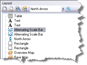
Production Mapping also provides tools to help you manage your layout. The Layout window provides tools to measure the layout and layout rules to define the placement of elements in the layout. The Layout window also allows you to manage order and visibility of elements as well as lock elements in place.

Grids and graticules
The Production Cartography toolbar allows you to create grid templates and work with layers created with the Make Grids And Graticules Layer geoprocessing tool.

Data Reviewer
ArcGIS Data Reviewer provides tools for quality control or validation of your data. Data Reviewer can help you streamline the processes of finding, fixing, and verifying issues with your data.
Reviewer table
The Reviewer table is the location where information about data is recorded. The Reviewer table can record issues or anomalies with your data as well as store sample sets of your data or information about features that may need further evaluation or analysis.

Checks
Data Reviewer provides a number of different automated checks that can be configured to validate your data. The Select Data Check drop-down list on the Data Reviewer toolbar and the shortcut list on the Batch Job Manager can both be used for configuring checks. Checks are divided into categories such as Database Validation and Feature on Feature.

Toolbars
The Data Reviewer toolbar provides access to the most commonly used validation functionality. From this toolbar, you can create a Reviewer session, open the Positional Accuracy Assessment toolbar, and configure Reviewer checks.

Data Reviewer provides tools to help you determine the positional accuracy of your features through the Positional Accuracy Assessment toolbar.

ArcCatalog
A number of Production Mapping tools are available in ArcCatalog. These tools are used primarily for importing and exporting data to various formats and are available on the Production Mapping toolbar.

ArcToolbox
Production Mapping includes a number of geoprocessing tools for all aspects of large-scale production including editing, data validation, and cartography. The Production Mapping tools are included in the Data Reviewer Tools toolbox and the Production Mapping Tools toolbox.

For more information, see An overview of the Production Mapping toolbox