This topic provides definitions for a series of key terms used in ArcCatalog.
Catalog tree
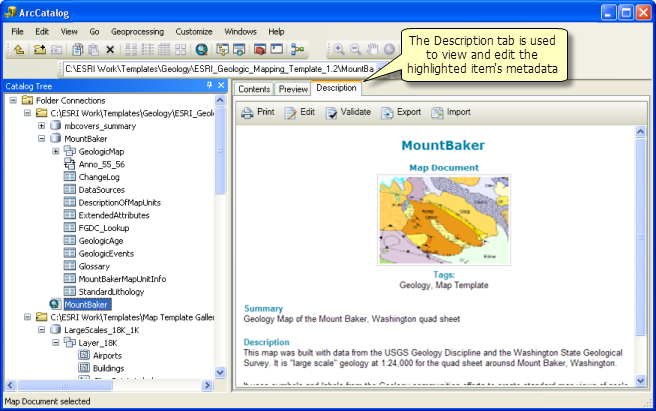
The contents panel in ArcCatalog that helps you organize and manage your ArcGIS content in file folders (which are sometimes referred to as "workspaces") and in geodatabases. GIS information items include map documents; geoprocessing models and toolboxes; and file-based datasets such as imagery, layer files, and globe documents. The Catalog tree is also the panel in which you make connections to GIS servers, shared geodatabases, and other services.
Preview window
The Preview window in ArcCatalog displays information about items that you highlight in the Catalog tree. There are a number of preview options. You can view the geography of your datasets, the attribute tables, or the item descriptions. 
Workspace
A workspace is a file folder that contains ArcGIS contents. These are items that you create and work with in ArcGIS—file and personal geodatabases, ArcMap documents (.mxd), ArcGlobe documents (.3dd), image files, geoprocessing toolboxes (.tbx), locators for geocoding (.loc), Python scripts (.py), layer packages (.lpk), and so on. ArcCatalog helps you organize and manage your ArcGIS content in a series of workspaces.
Metadata
Documentation about ArcGIS items; also referred to as item descriptions. Metadata is the term used by geospatial organizations for their GIS item descriptions using a standards-based schema. This enables ArcGIS users to document their items using an agreed-upon metadata standard that is supported by a large community of users. Standards-based metadata enables these communities to publish metadata catalogs for all participants to discover and share their geographic information. ArcGIS includes a Geoportal extension for ArcGIS for Server for building and serving metadata catalog services.
Item description
Documentation about items in ArcGIS. These are used when searching in ArcGIS for Desktop to find contents you want to use. Item descriptions are also uploaded into ArcGIS Online and other sharing sites. 
ArcGIS documents
How key elements in ArcGIS are stored—map documents (.mxd), layers (.lyr), globes (.3dd), 3D scenes (.sxd), and so on. Each document encapsulates your design and specifications for that item. For example, a map document has display specifications for its map layers and how the attributes are presented. The map document can also include design information for a page layout, its map elements, and their properties used in map printing; for how features in each layer are edited; and other information.