Summary
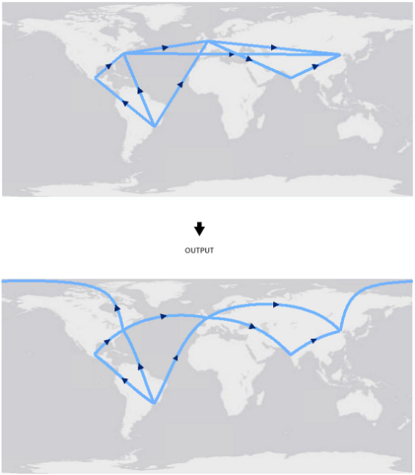
Creates new features by replacing input feature's segments with densified approximations of geodesic segments. Four type of geodesic segments can be constructed: Geodesic, Great Elliptic, Loxodrome, and Normal Section.
Illustration

Usage
The end points of the segments will be connected using a geodetic approximation. The input segment type is irrelevant; linear and non-linear (circular arc, elliptic arc, and Bezier curve) segments with common end points will yield the same output.
No output feature will be written for input features made of a single segment with coincident start and end point. For example, a polygon feature made of a single circular arc will not be written to the output.
Syntax
GeodeticDensify_management (in_features, out_feature_class, geodetic_type, {distance})| Parameter | Explanation | Data Type |
in_features | The input line or polygon features. | Feature Layer |
out_feature_class | The output feature class containing the densified geodesic features. | Feature Class |
geodetic_type | The type of geodetic segment to construct. Geodetic calculations are performed on the ellipsoid associated with the input data's coordinate system.
| String |
distance (Optional) | The distance between vertices along the output geodesic segment. The default value is 50 kilometers. | Linear unit |
Code sample
GeodeticDensify example 1
Simple example of running geodeticDensify tool in python.
import arcpy
arcpy.GeodeticDensify_management(r"C:\data.gdb\flight_lines", r"C:\data.gdb\flight_lines_geodesic", "GEODESIC")
Environments
Licensing information
- ArcGIS for Desktop Basic: No
- ArcGIS for Desktop Standard: Yes
- ArcGIS for Desktop Advanced: Yes