ArcGIS Desktop

  • Documentation
  • Support

  • My Profile
  • Help
  • Sign Out
ArcGIS Desktop

ArcGIS Online

The mapping platform for your organization

ArcGIS Desktop

A complete professional GIS

ArcGIS Enterprise

GIS in your enterprise

ArcGIS for Developers

Tools to build location-aware apps

ArcGIS Solutions

Free template maps and apps for your industry

ArcGIS Marketplace

Get apps and data for your organization

  • Documentation
  • Support
Esri
  • Sign In
user
  • My Profile
  • Sign Out

ArcMap

  • Home
  • Get Started
  • Map
  • Analyze
  • Manage Data
  • Tools
  • Extensions

Calculating cost of travel

Available with Spatial Analyst license.

Use the ArcGIS Spatial Analyst extension to calculate the cost of traveling across a surface. Travel cost analysis involves generating a cost surface and calculating optimum corridors across the surface. Calculating travel cost can be informative for decision making.

The following map displays the least-cost travel for timber transport within a 200-mile radius of each mill. It considers travel obstacles and estimates the cost in dollars to transport wood from each location to the nearest mill. Once the accumulated least-cost path of travel has been calculated, it is easy to identify the shortest path from any location to the nearest mill.
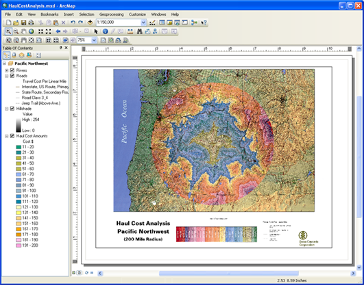
Least travel cost for timber to mill
Map of least-cost travel for timber within certain radius of each mill

Related topics

  • Sample applications using Spatial Analyst

ArcGIS Desktop

  • Home
  • Documentation
  • Support

ArcGIS Platform

  • ArcGIS Online
  • ArcGIS Desktop
  • ArcGIS Enterprise
  • ArcGIS for Developers
  • ArcGIS Solutions
  • ArcGIS Marketplace

About Esri

  • About Us
  • Careers
  • Insiders Blog
  • User Conference
  • Developer Summit
Esri
Tell us what you think.
Copyright © 2017 Esri. | Privacy | Legal