Use the following steps to display and use the Location Referencing toolbar in ArcMap.
- Starten Sie ArcMap.
- Click Customize > Toolbars > Location Referencing.
The Location Referencing toolbar appears.

Identify LRS Route Locations
Upon clicking on a Route, the Identify LRS Route Locations tool  will bring up a table in ArcMap that displays the details of one or more routes along a Line network or LRS network.
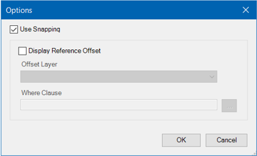
You can filter the layers by clicking on the Layers drop-down arrow and choose Network . Click Options to provide the ability to snap the Identify LRS Route Locations tool to one or more Network layers, as well as to display Reference Offset.
Set Date Filter
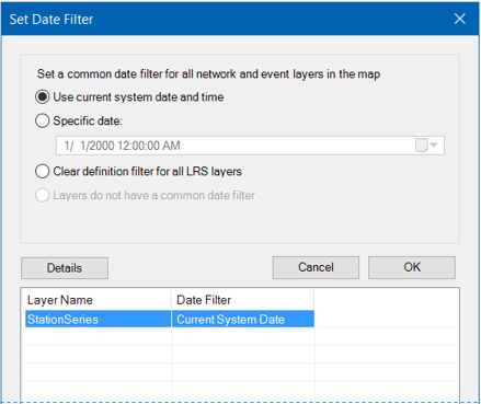
The Set Date Filter tool  sets a common date filter for all network and event layers in the map, as well as provides an option to clear any date filters that are set. A use for this tool would be to clear the definition filter for any layers that will be published as a map service, which is a requirement for use in ArcGIS Event Editor. This information can be manually edited in the Definition Query tab of the layer properties for individual layers.