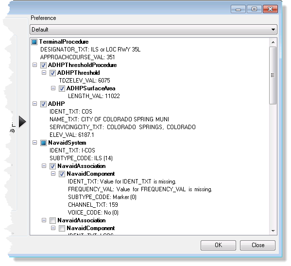
The Ancillary Information Table tool creates a formatted table containing ancillary terminals information, such as servicing city, runway and airport identifiers, and primary navaid component information for an airport.

- Start ArcMap.
- Add the TerminalsProcedure table to the table of contents and add a definition query to the table.
- On the main menu, click View > Layout View.
- If necessary, add the Ancillary Information Table tool by doing the following:
- On the main menu, click Customize > Customize Mode.
The Customize dialog box appears.
- Click the Commands tab.
- In the Categories list, choose Aviation.
- In the Commands list, click and drag the Ancillary Information Table button
 to a toolbar.
 - Click Close.
- On the main menu, click Customize > Customize Mode.
- Click the Ancillary Information Table button
 .
.The Ancillary Information dialog box appears.

- Click the Preference drop-down arrow and choose the preference to be used to create the table.
- In the right pane, check the check boxes to choose which items will be included in the table.
The preview is updated in the left pane to show changes.
- Highlight any line of text in the right pane to show the Edit Values text box.
- Enter a value or change the current value and click Update Database.
This updates the data in the database directly based on the value entered.
- Click OK.
The ancillary information table appears in the chart layout.