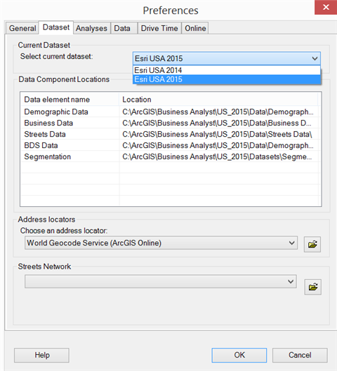
Use the Dataset tab to select the current dataset, view data component locations, set the geocoding service, and choose the street network you want to use.
The Dataset tab is used to set locations for major data components that come with the product—that is, Esri demographic data, Infogroup business listings, NAVTEQ street data, and so on—as well as your preferences for address locator (geocoder). In most cases, you will be using the USA Geocoding Service provided with Business Analyst.

Current Dataset
Use the Select current dataset drop-down menu to select the current dataset. The active dataset is always shown. The Esri USA 2015 dataset contains each of the data components, locators and street networks.
Data Component Locations
The Business Analyst source data is listed here. You can change the data sources by double-clicking on any element to navigate to another location.
Address locators
If the ZIP+4 geocoding data is installed, you can change the geocoding service in the Choose an address locator drop-down menu. Navigate to \ArcGIS\Business Analyst\US_2015\Data\USA Geocoding Service\ and select USA Geocoding Service4. This activates the ZIP+4 locator in the wizards.
Streets Network
Your routing service is set by default to C:\ArcGIS\Business Analyst\US_2015\Data\Streets Data\NAVTEQ_2014_Q3_NA.gdb\streets\NAVTEQ_NA_ND. You can change this to another custom routing service using the Streets Network drop-down menu.