Provides a variety of global Territory Design settings.
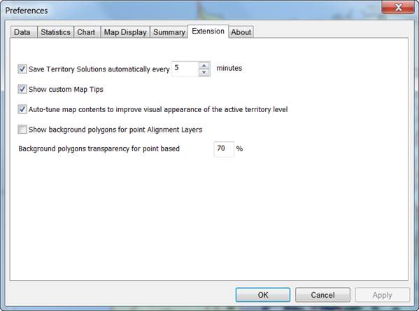
- Check the Save Territory Solutions automatically every <integer> minutes checkbox to specify how often Territory Solutions are automatically saved. You can enter from 1 to 1000 minutes.
- Check the Show custom Map Tips checkbox to show custom map tips. These pop-up menus show statistics for each overall territory and their individual element.
- Check the Auto-tune map contents to improve visual appearance of the active territory level checkbox to specify auto-tune options (formerly Edit mode). Enabling auto-tuning allows you to work with territories that contain multiple hierarchies. When enabled, boundary lines for the active level of territories are increased and show the geography elements of its base layer, making hierarchy levels easily distinguishable. Also, other territory levels on the map become temporarily invisible.
- Check the Show background polygons for point Alignment Layers checkbox to show background layers for point alignment layers to improve the visualization of territory boundaries.
- Input into Background polygons transparency for point based a percentage to set the transparency of point alignment layer background polygons. The default setting is 70 percent transparency.