Available with Standard or Advanced license.
When interacting with a map, you may want to select features based on elevation. The Select By Z Value tool allows you to query data layers using z-values, then select features based on them.
For instance, suppose you want to see how many bridges have an elevation of 100. You could create a new selection set and choose BridgeL as the selectable layer, then only features with a z-value of 100 would be selected in the map.
- Start ArcMap.
- On the main menu, click Customize > Toolbars > Defense Mapping.
- Click the Select By Z Value button
 on the Defense Mapping toolbar.
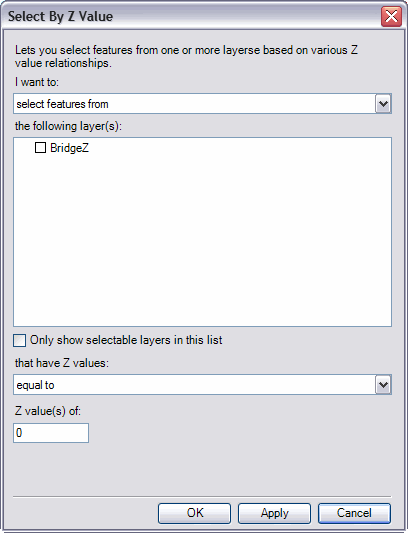
The Select By Z Value dialog box appears.

- Check the Only show selectable layers in this list check box if you want only selectable layers to display in the the following layer(s) list.
- Click the I want to drop-down list and choose one of the following options:
- Select features from—This option allows you to select features from the layers checked in the the following layer(s) list.
- Add to the currently selected features in—This option allows you to add to the features selected in the layers checked in the the following layer(s) list.
- Remove from the currently selected features in—This option allows you to remove features from the currently selected features in the layers checked in the the following layer(s) list.
- Select from the currently selected features in—This option allows you to select features from the currently selected features in the layers checked in the the following layer(s) list.
- In the the following layer(s) list, check the check boxes next to the layers you want to use for the selection set.
- Click the that have Z values drop-down arrow and choose one of the following options:
- Equal to—Selects features whose z-values are equal to what is specified in the Z value(s) of text box.
- Not equal to—Selects features whose z-value are not equal to what is specified in the Z value(s) of text box.
- Greater than—Selects features whose z-values are greater than what is specified in the Z value(s) of text box.
- Greater than or equal to—Selects features whose z-values are greater than or equal to what is specified in the Z value(s) of text box.
- Less than—Selects features whose z-values are less than what is specified in the Z value(s) of text box.
- Less than or equal to—Selects features whose z-values are less than or equal to what is specified in the Z value(s) of text box.
- Within—Choosing this option causes two Z value(s) of text boxes to appear for you to define minimum and maximum z-values. This option then selects features with z-values that are within the two z-values defined in the text boxes.
- Equal to or within—Choosing this option causes two Z value(s) of text boxes to appear for you to define minimum and maximum z-values. This option then selects features with z-values that are within or equal to the two z-values defined in the text boxes.
- Type a z-value in the Z value(s) of text box.
- Click OK.