ArcGIS Desktop

  • ArcGIS Pro
  • ArcMap

  • My Profile
  • Help
  • Sign Out
ArcGIS Desktop

ArcGIS Online

The mapping platform for your organization

ArcGIS Desktop

A complete professional GIS

ArcGIS Enterprise

GIS in your enterprise

ArcGIS for Developers

Tools to build location-aware apps

ArcGIS Solutions

Free template maps and apps for your industry

ArcGIS Marketplace

Get apps and data for your organization

  • Documentation
  • Support
Esri
  • Sign In
user
  • My Profile
  • Sign Out

Help

  • Home
  • Get Started
  • Map
  • Analyze
  • Manage Data
  • Tools
  • More...

Coordinate display and the ArcGIS for Maritime: Charting

The coordinates are displayed in the status bar as latitude, longitude (y,x) when the display units are geographic coordinates and the ArcGIS for Maritime: Charting extension is enabled. Geographic coordinates include Decimal Degrees (DD), Degrees Minutes Seconds (DMS), and Degrees Decimal Minutes (DDM). All other display units are still represented as x,y. The display units are set on the General tab of the Data Frame Properties dialog box.
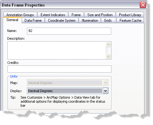
Data Frame Properties dialog box

ArcGIS Desktop

  • Home
  • Documentation
  • Support

ArcGIS Platform

  • ArcGIS Online
  • ArcGIS Desktop
  • ArcGIS Enterprise
  • ArcGIS for Developers
  • ArcGIS Solutions
  • ArcGIS Marketplace

About Esri

  • About Us
  • Careers
  • Esri Blog
  • User Conference
  • Developer Summit
Esri
Tell us what you think.
Copyright © 2020 Esri. | Privacy | Legal