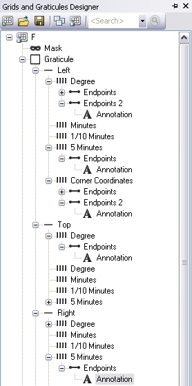
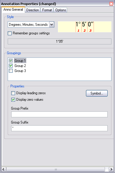
The INT2 grid XML files are configured to display all directional characters with an "N" for latitudes and a "E" for longitudes. Although grid annotation can be edited after the grid is created, you may want to create several grids that use characters other than "N" and "E." To do this, you can use the Grids and Graticules Designer to edit the existing grid XML files and save them to a new file that is configured to use other characters, like an "S" or an "E;" custom national characters; or no characters at all. This has to be done only once for each grid XML file you want to modify. Once you have modified the XML file, all new grids will display the characters you defined.
- Start ArcMap if necessary.
- On the Nautical Cartography toolbar, click Grids > Grids and Graticules Designer.
- Click the Open button
 at the top of the Grids and Graticules Designer window.
The Open dialog box appears.
- Navigate to the following location:
- For 32-bit Windows operating systems—<Installation location>\Program Files\ArcGIS\MaritimeCharting\Desktop10.3.1\Charting\Cartography\GridDefinitions
- For 64-bit Windows operating systems—<Installation location>\Program Files(x86)\ArcGIS\MaritimeCharting\Desktop10.3.1\Charting\Cartography\GridDefinitions
- Click the appropriate XML file to select it.
- Click Open.
The grid is loaded into the Grids and Graticules Designer window.

- From the tree view, double-click the annotation component you want to change.
- If necessary, scroll down on the Anno General tab to the Groupings and Properties areas.

- Click the Group Suffix text box, delete the current character, then type the character you want.
- Repeat steps 7 through 9 as needed.
- Click the top component in the tree view.
- Click the Save As button
 at the top of the Grids and Graticules Designer window.
The Save as dialog box appears.
- Browse to an output location to save the file and rename the file appropriately.
- Click Save.
You now have a new grid XML that will generate grids with the new Group Suffix values you have defined.