Available with Standard or Advanced license.
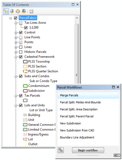
When the Local Government Information Model is enabled on a parcel fabric, parcel types, attributes, and domains that reflect the editing requirements of Local Government parcel maintenance are added to parcel fabric tables. The parcel fabric layer is displayed and symbolized using the Local Government configuration, and the parcel fabric can be used in efficient and automated parcel editing workflows.

Using the parcel editing workflows
There are eight parcel editing workflows available. Each parcel editing workflow describes in detail, the manual steps required to complete the workflow. To use the workflows :
- Follow the manual steps using the sample data.
- Use the automated parcel editing workflows listed on the Parcel Workflows dialog box on the sample data.
The parcel editing workflows use the sample dataset downloaded with the Tax Parcel Editing map on the ArcGIS Solutions website. To use the automated workflows on the sample data, enable the parcel fabric in the ParcelEditing feature dataset with the Local Government Information Model and drag the parcel fabric into an empty map document. Automated parcel editing workflows are listed on the Parcel Workflows window, which can be opened by clicking Parcel Editor > Parcel Workflows on the Parcel Editor toolbar.
The following parcel editing workflows are available:
- Merge Parcels
A workflow for merging or combining tax parcels.
- Parcel Split: Metes-And-Bounds
A workflow for splitting tax parcels using a metes and bounds description.
- Parcel Split: Area Description
A workflow for splitting tax parcels using an area-based description.
- Parcel Split: Parent Parcel
A workflow for splitting tax parcels by constructing split lines.
- New Subdivision
A workflow for creating a new subdivision.
- New Subdivision from CAD
A workflow for creating a new subdivision from CAD lines.
- Boundary Line Adjustment
A workflow for adjusting tax parcel boundary lines.
- Parcel Corner Location Update
A workflow for making temporary, ad-hoc spatial updates to parcel boundaries and points. Not available as an automated workflow.
Automated parcel workflows settings
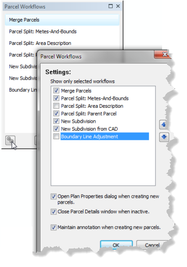
You can configure the settings of the automated parcel editing workflows. On the Parcel Workflows window, click the settings icon located at the bottom left corner to change the visibility and display of workflows and to change workflow functionality.
