Available with Standard or Advanced license.
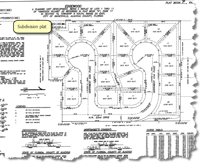
The parcel fabric organizes parcel data based on the form in which the data was originally recorded. In most cases, parcel data is recorded on plans, or records of survey. Plans/Plats, or records of survey, are legal documents used by surveyors and engineers to describe and map the findings of their fieldwork. Parcels are created and edited in response to changes in the legal record. Changes in the legal record are typically reflected in the submission of a new plan or record of survey.
In addition to a drawing of the survey measurements, plans contain other information such as the following:
- The legal description of the surveyed area
- Easement and right-of-way description
- Landownership information
- Approval statements
- Name of the surveyor
- Legal date the plan was recorded
- Survey date
- Plan units
A parcel in the parcel fabric is stored under one plan or record of survey.

If you do not want to use plans in the parcel fabric, you can use the system, default <map> plan to store your parcels.
Creating a new plan
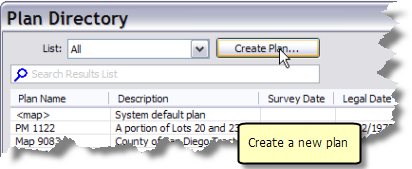
New plans are created from the Plan Directory dialog box in the parcel fabric. The Plan Directory dialog box displays a list of plans/plats or records of surveys existing on the current parcel fabric. Click the List drop-down box to search for plans by date, current map extent or by attribute query.
To create a new plan in the parcel fabric, follow these steps:
- In an edit session in ArcMap, click the Parcel Editor arrow on the Parcel Editor toolbar and click Plan Directory.
- On the Plan Directory dialog box, click Create Plan to create a new plan.
- On the Plan Properties dialog box, click the General tab and enter a name for your new plan.
- Click the Record Format tab to specify the units that you will be working with in this plan.
Choose the appropriate units for Direction or Angle Type, Direction and Angle Units, Distance and Length Units and Area Units. Parcels created in this plan will be entered and stored in these units.
- Choose the appropriate values for Circular Curve Parameters and Circular Curve Direction. Curves for parcels created in this plan will be entered and stored using these parameters. You will be able to identify which curve parameters a plan uses by looking at the curve dimensions on the plan. Curve dimensions are sometimes displayed in a curve table for labeled curves on the plan.
- Click the Corrections tab and click Uses true mid-bearings if bearings of your parcel lines in the plan are the bearings from true north at the midpoint of the parcel. This option is typically used for very long parcel lines.
- Click the Attributes tab to populate plan attributes such as the LegalDate and accuracy category.
- Click OK on the Plan Properties dialog box to create the plan.

All new parcels created under this plan will also inherit the specified accuracy category. Accuracy categories are used by the parcel fabric adjustment.
Assigning plans to groups of parcels
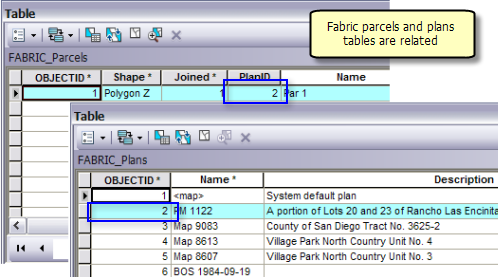
In the geodatabase, parcels in a parcel fabric are related to their plans through the PlanID field in the Parcels attribute table. Plans are stored in the Plans table; the plan ID is a unique identifier for each plan in the Plans table. You can assign a plan to a selection of parcels by editing the PlanID field in the Parcels attribute table.

To assign a plan to a group of parcels, you need to know the plan ID of the plan. You can find the plan ID in the ObjectID field in the Plans table. The plan ID can then be entered or calculated in the PlanID field in the Parcels attribute table.
To assign a plan to a group of parcels, follow these steps:
- On the Catalog window in ArcMap, open the Make Parcel Fabric Table View geoprocessing tool located under Toolboxes > System Toolboxes > Parcel Fabric Tools.tbx > Layers And Table Views.
- On the Make Parcel Fabric Table View dialog box, click the drop-down arrow under Target Parcel Fabric to select the target parcel fabric.
- Select the Plans table under Select Parcel Fabric Table.
- Type a table view name for the plans table under Output Table View.
- Click OK to create the table view.
- Right-click the plans table view and click Open to open the attribute table.
- Click Parcel Editor > Start Editing to start an edit session.
- Using the Select Parcel Features tool
 , select the parcels to which you want to assign a plan.
 - Right-click the Parcels sublayer on the Table Of Contents window and click Open Attribute Table.
- Click the Show Selected Records
 button located at the bottom of the table.
 - Save the edit session.