You can work with many types of GIS servers. The first step in every case is to establish a connection to the GIS server in the Catalog window. This topic describes the steps for each type of GIS server.
Connecting to ArcGIS for Server
You can connect to an ArcGIS Server site using the Catalog window in ArcMap, ArcScene, or ArcGlobe. There are three levels of connection you can make—user, publisher, or administrative—which determine the functions you're allowed to perform on the server once you make the connection. When you connect, you type in a user name and password, which the server checks to see whether you have the permissions to make the type of connection you're requesting.
The links below take you to more detailed instructions about connecting to ArcGIS for Server.
Connecting to ArcIMS
Here are the steps to connect to an ArcIMS server in ArcMap, ArcScene, or ArcGlobe:
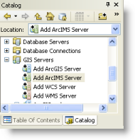
- In the Catalog window, expand the GIS Servers node and double-click Add ArcIMS Server.

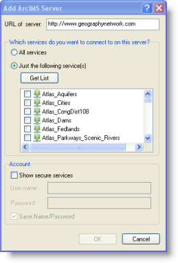
The Add ArcIMS Server dialog box appears.
- Type the ArcIMS server URL and other properties for your ArcIMS connection.

- Click OK.
The ArcIMS server connection is added as an item in your GIS Servers tree view. You can expand and work with the services provided by this connection.
Connecting to WMS, WMTS or WCS
Here are the steps to connect to WCS and WMS servers in ArcMap, ArcScene, or ArcGlobe:
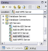
- In the Catalog window, expand the GIS Servers node and double-click Add WCS Server, Add WMS Server or Add WMTS Server.

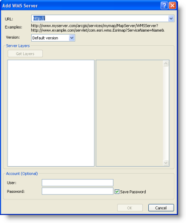
The Add WMS Server, Add WMTS Server or Add WCS Server dialog box appears.
- Type the server URL and other properties for your connection.

- Click OK.
The WMS, WMTS or WCS server connection is added as an item in your GIS Servers tree view. You can expand and work with the services provided by this connection.