ArcGIS for Desktop

  • Documentation
  • Pricing
  • Support

  • My Profile
  • Help
  • Sign Out
ArcGIS for Desktop

ArcGIS Online

The mapping platform for your organization

ArcGIS for Desktop

A complete professional GIS

ArcGIS for Server

GIS in your enterprise

ArcGIS for Developers

Tools to build location-aware apps

ArcGIS Solutions

Free template maps and apps for your industry

ArcGIS Marketplace

Get apps and data for your organization

  • Documentation
  • Pricing
  • Support
Esri
  • Sign In
user
  • My Profile
  • Sign Out

Help

  • Home
  • Get Started
  • Map
  • Analyze
  • Manage Data
  • Tools
  • More...

Creating an interoperability connection

The ArcGIS Data Interoperability extension adds support for a large number of nonnative spatial data and table formats. You can create interoperability connections to supported formats and manage them in the Catalog tree as direct-read datasets. You can use interoperability connections anyplace where you can specify a data source, such as adding data to ArcMap or as input to geoprocessing tools.

Installing the Data Interoperability extension enables interoperability connections for reading WFS services and GML-SF (simple features) datasets. Purchasing a Data Interoperability license and enabling the extension in the ArcGIS for Desktop application adds additional out-of-the-box support for GIS, CAD, raster, and database formats.

The following steps describe how to create an interoperability connection:

  1. In Catalog Tree, expand the Interoperability Connections folder.
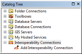
    Interoperability Connections in Catalog Tree
  2. Double-click Add Interoperability Connection.
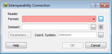
    Interoperability Connection
  3. Click the Format browse (ellipsis) button to open FME Reader Gallery.
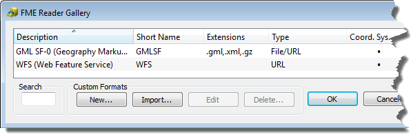
    FME Reader Gallery
  4. Choose the desired format and click OK.
  5. Click the Dataset browse (ellipsis) button and select the dataset.
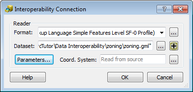
    GML dataset
  6. Click OK to close the Interoperability Connection dialog box.
Feedback on this topic?

ArcGIS for Desktop

  • Home
  • Documentation
  • Pricing
  • Support

ArcGIS Platform

  • ArcGIS Online
  • ArcGIS for Desktop
  • ArcGIS for Server
  • ArcGIS for Developers
  • ArcGIS Solutions
  • ArcGIS Marketplace

About Esri

  • About Us
  • Careers
  • Insiders Blog
  • User Conference
  • Developer Summit
Esri
© Copyright 2016 Environmental Systems Research Institute, Inc. | Privacy | Legal