Available with Advanced license.
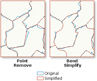
Simplifying natural feature polygons
Simplifying a natural feature polygon involves removing extraneous bends and small intrusions and extrusions from its boundary without destroying its essential shape. The Simplify Line Or Polygon tool reduces details from polygons when the input coverage contains polygon topology, based on a specified tolerance and simplification method. The two simplification methods are POINT REMOVE and BEND SIMPLIFY.
Simplifying building polygons and finding conflicts
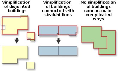
Simplifying building polygons means reducing details in the boundaries of buildings while maintaining the essential shape and size of the buildings. Buildings are generally orthogonal areas; therefore, the simplification process will preserve and enhance orthogonality.
Each separate building will be simplified by itself. Buildings connected with straight lines will be simplified as a group. Buildings connected in more complicated ways will not be simplified.
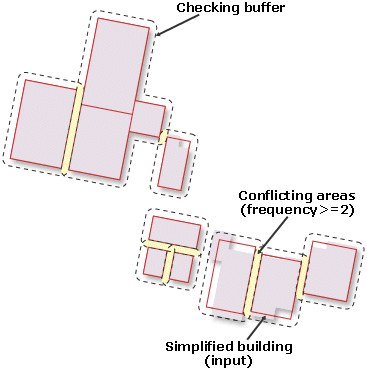
Finding conflicts among buildings is a part of the postprocessing of simplifying buildings. It helps you locate the conflict areas by creating a buffer around each building or group of connected buildings. A conflict occurs where the buffers overlap. The overlapping area gets a FREQUENCY value of 2 or more in out_cover.PAT, according to how many buffers overlap.
Aggregating polygons based on distance
When map scale is reduced such that small spacing between polygons cannot be represented anymore, the polygons (adjacent or disjoint) can be combined into new area features based on a specified distance. Aggregating polygons preserves the distinctive characteristics of the features.
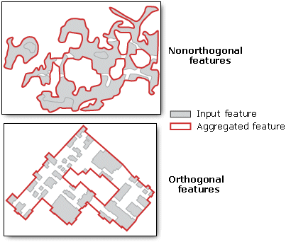
Dissolving polygons or regions based on attributes
Dissolving polygons merges adjacent polygons or regions that have the same value for a specified item. This figure shows an example of how the polygons sharing the same CODE values are merged into new polygons:

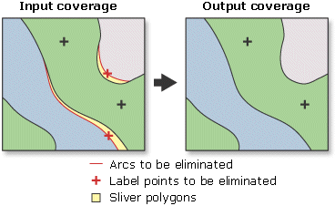
Eliminating polygons
Eliminating polygons merges the selected polygons with neighboring polygons if they have the largest shared border or the largest area. It is used most often to remove sliver polygons created in an overlay of two coverages.
