The Update tool creates a new coverage by overlaying two sets of features. The features of the update coverage define the updating extent. Update uses the updating extent in a cut and paste operation; update coverage features replace the area they overlap in the input coverage. The result is stored in the output coverage.
Both the input and update coverages must have polygon topology. Topology is rebuilt for the output coverage. Attributes are updated. Items in the polygon feature class are merged using the old internal number of each polygon.
The following illustrations are examples of the cut and paste function performed by Update. Attribute values in the output coverage polygon feature class are updated. Polygon User-IDs are unique between the input coverage and the update coverage. This can help facilitate the tracking of feature attributes after Update.
The Erase tool is similar to Update, except that the input coverage features that overlap the updating extent are erased instead of updated. Erase can also be used on arc and point features.
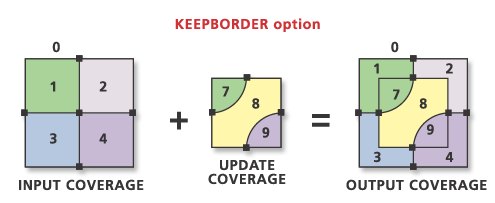
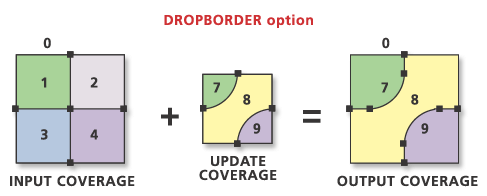
Update maintains region subclasses in the output coverage only with the KEEP_BORDER option. How region subclasses are updated depends on the extent of the regions in both the input coverage and the update coverage region subclasses. The following illustrations indicate how region subclasses are maintained with Update.
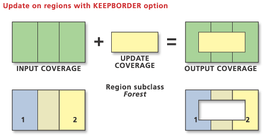
The update coverage does not have a region subclass Forest. Consequently, a void area is created where the update coverage "covers" the regions of the input coverage.
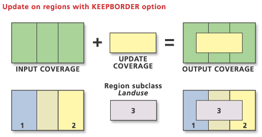
Update performs a cut and paste type operation based on the extent of the update coverage. In this case, the shape of the region subclass Landuse features 1 and 2 of the input coverage is changed by the shape of the region subclass Landuse feature 3 of the update coverage.
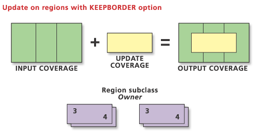
The region subclass Owner does not exist in the input coverage. The update subclass has two fully overlapping regions that are maintained in the output coverage.
Feedback on this topic?