Available with 3D Analyst license.
Follow these steps to use the LAS To Multipoint geoprocessing tool to import one or more LAS files into a multipoint feature class. ArcGIS supports LAS versions 1.0, 1.1, 1.2, and 1.3. The waveform information that is available when using LAS version 1.3 is not supported. Additionally, LAS version 1.4 files that are 1.3 compliant.
Each LAS file contains metadata of the lidar survey in a header block followed by individual records for each laser pulse recorded.
- In ArcToolbox, expand 3D Analyst Tools, expand the Conversion tools, then expand the From File tools.
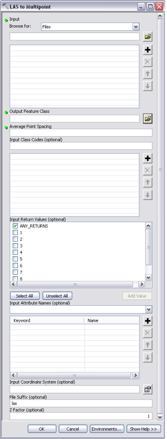
- Double-click the LAS To Multipoint tool to open it. The LAS to Multipoint dialog box appears (see below).
- From the Input Browse for drop-down menu, choose either Folders or Files.
- Click the Input Browse button
 to navigate to the LAS files you want to import.
- Highlight the LAS files you want to import and click Open. You can use the SHIFT or CTRL key to select more than one LAS file.
- Click the Output Feature Class browse button
 to set the location of the output feature class. All feature classes contributing to a terrain dataset must reside in the same feature dataset. It is recommended that you set the output feature class to be the feature dataset where the terrain dataset will be created.
- Set the Average Point Spacing for the input LAS data.
- Optionally, specify an Input Class Code.
- Optionally, type an Input Return Value.
- Optionally, specify Input Attribute Names.
- Optionally, specify an Input Coordinate System.
- Optionally, set the File suffix.
- Click OK.
