Available with 3D Analyst license.
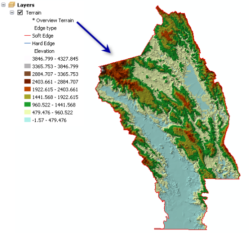
The overview terrain is the coarsest representation of the terrain dataset and is intended for fast drawing at small scales. The overview is what's drawn by default when zoomed to the full extent of the terrain dataset. It is a vector-based thumbnail representation.
Point based data sources are always used in the overview terrain. Other Feature classes participating in the terrain can be represented in the overview by setting this property to TRUE in the creation process.
Only set those feature classes that must be represented in the overview to TRUE. For example, you probably don't need detailed breaklines, but you might need a clip polygon, particularly if the data boundary is irregularly shaped. If the boundary you have is detailed, generalize it and use the coarser representation for the overview. The detailed version should be used in more detailed pyramid levels.
The following image depicts an overview representation of the terrain dataset. The table of contents shown displays the current resolution this terrain is displayed at: Overview Terrain.
