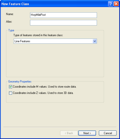
When you create a new route feature class, you will use the standard tool for creating a new feature class. In the dialog box, you will specify that the feature class has m-coordinates by checking the box that indicates that the feature coordinates will include m-values.

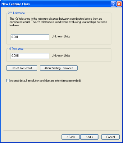
In the next panel (shown below), you can set the m-tolerance or accept the default value. The m-tolerance defines the tolerance for clustering m-values during processing. Its default value is 0.001 units. If coordinates are coincident and their m-values are within this tolerance, they will be set equal to one another.

In almost all cases, accepting the default m-tolerance will work for you. However, if your measure values are quite small and you want to ensure that measures do not cluster if they fall within 0.001 units of each other, you can specify your own m-tolerance.
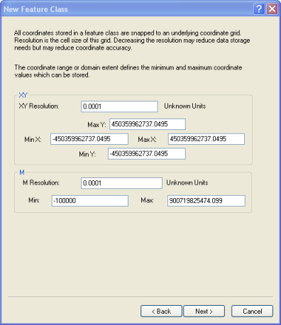
Also in this panel, if you want to change the m-resolution, uncheck the Accept default resolution field. Youare presented in the next panel with the opportunity to set some coordinate properties for m-resolution and the m-range:

M-resolution defines the resolution of your m-values. Its default value is 0.0001 units, which is the default m-tolerance divided by 10. This means the m-values will be stored with an accuracy of four decimal places. If your m-measures represent something using very small incremental values with multiple decimal places, you might want to set your own m-resolution. For example, an m-resolution of 0.000001 will store m-values with accuracy to six decimal places.
The m-resolution and the m-domain extent (Min and Max) are directly related to each other. When the m-resolution is altered, the mmaximum value is recalculated to the largest value allowed based on the resolution. You can also set the range of m-values by setting the lowest (Min) value and the highest (Max) value . The m-resolution will be recalculated to the finest resolution possible based on the minimum and maximumm-values entered.