When model outputs are added to the ArcMap table of contents, their symbology can be predefined by referencing a layer file (.lyr).
Setting symbology using layer file
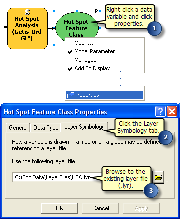
Model data variables have a Layer Symbology property wherein a layer file can be specified to define the symbology of the variable when it is added to the ArcMap table of contents.
- Create a layer file containing the desired symbology.
- Right-click a data variable in a model and click Properties.
- On the Layer Symbology tab, enter the path of the layer file.

Layer symbology support
Layer Symbology is only supported for variables of the following data types:
- Feature Class
- Feature Layer
- Raster Dataset
- Raster Layer
- TIN dataset
- TIN Layer
- Network Analysis Layer
List of supported geometry types for layer symbology
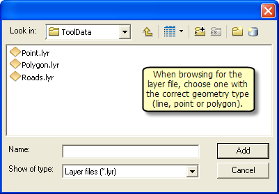
For feature classes, the symbology layer file must be the correct geometry type (point, line, or polygon). That is, a polygon symbology cannot be defined for a point feature class variable.
