ArcGIS Desktop

  • ArcGIS Pro
  • ArcMap

  • My Profile
  • Help
  • Sign Out
ArcGIS Desktop

ArcGIS Online

The mapping platform for your organization

ArcGIS Desktop

A complete professional GIS

ArcGIS Enterprise

GIS in your enterprise

ArcGIS for Developers

Tools to build location-aware apps

ArcGIS Solutions

Free template maps and apps for your industry

ArcGIS Marketplace

Get apps and data for your organization

  • Documentation
  • Support
Esri
  • Sign In
user
  • My Profile
  • Sign Out

ArcMap

  • Home
  • Get Started
  • Map
  • Analyze
  • Manage Data
  • Tools
  • Extensions

Accessing the metadata for selected datasets

The Explore Bathymetry tool allows you to define filters based on the metadata values associated with the bathymetry datasets. You can also update the extended metadata values within the Explore Bathymetry window using the Edit Properties tool.

Note:

Any updates made to the extended metadata fields through the Edit Properties dialog box could potentially affect the current bathymetry dataset filter defined in the Explore Bathymetry window.

  1. Start ArcMap.
  2. Click Customize > Toolbars > Bathymetry on the main menu to activate the Bathymetry toolbar if necessary.
  3. Click the Explore Bathymetry button Explore Bathymetry on the Bathymetry toolbar.

    The Explore Bathymetry window appears. The right side of the window lists all bathymetry datasets in the active BIS geodatabase.

    Explore Bathymetry window
  4. To access the metadata for all datasets currently listed in the Filtered Datasets list, click the Edit Properties button Edit Properties at the top of the Explore Bathymetry window.

    Note:

    You can choose multiple datasets using the Shift or Ctrl keys. To access and edit metadata for only a particular dataset or group of datasets, right-click a dataset or a group and click Edit Properties or Edit Properties for Selected.

    The Edit Properties dialog box appears.
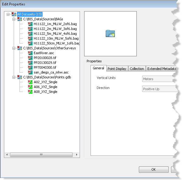
    Edit Properties dialog box
    Note:

    The All Datasets parent node is chosen by default. Any properties or metadata values that are shared by all datasets under this node will be reflected in the tab view. If values differ for the datasets in the dataset tree view, the value for that property or parameter will be blank.

  5. Click one of the datasets in the gridded data tree view to highlight it.

    The previously defined general, point display, collection, extended, and internal metadata values are listed and viewable for the chosen dataset.

    Note:

    You can also choose the All Datasets node or a dataset's parent folder to batch edit multiple datasets.

  6. Optionally update the applicable metadata fields on the Extended Metadata tab.

    Note:

    General, point display, collection, and internal metadata values are read-only.

  7. Click Apply.

    The metadata updates are applied to the chosen dataset.

  8. Optionally choose a different dataset listed in the gridded data tree view.
  9. Repeat steps 6 through 8 to update additional metadata fields as necessary.
  10. Click OK.

Related topics

  • Bathymetry filters
  • Adding filtered bathymetry from the Explore Bathymetry window
  • Adding filtered bathymetry from the Compose Surface window

ArcGIS Desktop

  • Home
  • Documentation
  • Support

ArcGIS Platform

  • ArcGIS Online
  • ArcGIS Desktop
  • ArcGIS Enterprise
  • ArcGIS for Developers
  • ArcGIS Solutions
  • ArcGIS Marketplace

About Esri

  • About Us
  • Careers
  • Esri Blog
  • User Conference
  • Developer Summit
Esri
Tell us what you think.
Copyright © 2019 Esri. | Privacy | Legal