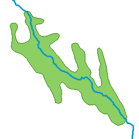
If you have a feature that crosses a polygon, you can use it to split the polygon—for example, if you want to divide a forest boundary at a road or river.

If you have an ArcGIS Desktop Standard or ArcGIS Desktop Advanced license, you can use the Split Polygons command to split polygons by overlapping features. Split Polygons allows you to split many polygons simultaneously. For example, this may be useful if you are creating new parcels from a larger tract polygon.
- Select the line or polygon features you want to use to split the existing polygon or polygon features. Only features that overlap the polygon are used in the split.
- Click Split Polygons
 on the Advanced Editing toolbar.
- Click the layer in which to store the new features. When splitting features this way, you choose the layer in which to store the new feature. This allows you to retain the attribute values from the existing feature, rather than having them be overwritten with values from a feature template.
- Optionally, type a cluster tolerance. You should use the default cluster tolerance or match the cluster tolerance of the geodatabase topology, if you are using one.
- Click OK.
With ArcGIS Desktop Basic, you can use the Cut Polygons tool on the Editor toolbar to perform this task. You can cut multiple polygons this way, but the cut line is based on a sketch you draw manually.
- Select the polygon.
- Click the Cut Polygons tool
 on the Editor toolbar.
- Click Trace
 on the Editor toolbar palette.
- Click and trace along the existing line or polygon. As you are tracing, you can change which features are being traced by pointing to them and clicking or dragging.
- Right-click anywhere on the map and click Finish Sketch.
The sketch must cross (or touch the edge) at least two
times for the polygon to be split.