Hatching is a type of labeling that is designed to post and label hatch marks or symbols at a regular interval along measured linear features. Hatching can be used for both distance-based measures and nondistance-based measures. Distance-based measures include kilometers, miles, feet, and meters. Nondistance-based measures include seismic shotpoint numbers in which measure values generally increase in even intervals based on some nominal distance. Below are examples using distance-based measures and nondistance-based measures.
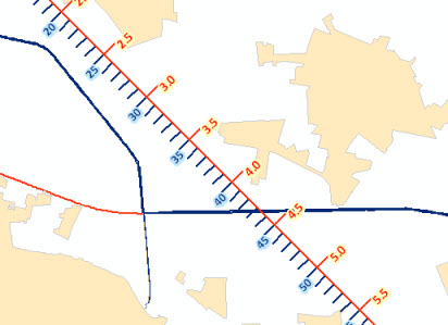
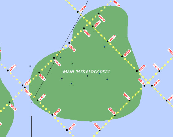
Hatch classes and definitions
To display hatches on a layer, you must define one or more hatch classes for the features you want to hatch. Each hatch class is composed of one or more hatch definitions.
Learn more about displaying hatches
Learn more about hatch definitions
The easiest way to understand hatch classes and hatch definitions is to use a ruler analogy. On a ruler, there is a series of vertical lines, or hatches, separated by a regular interval. For example, on a centimeter (cm) ruler, the hatches are typically spaced every millimeter (mm). One millimeter is 1/10 of a centimeter, so the hatch interval is 0.1.
Not all the hatches on a ruler are the same. Some are longer than others; some have text, while others do not. On a centimeter ruler, the hatches placed at every millimeter (0.1 cm) are shortest. The hatches placed at every 5 millimeters (0.5 cm) are a bit longer. The hatches placed every 10 millimeters (1 cm) are longest. The longest hatches typically have text to indicate the measure value.
In this example, the ruler is a hatch class. It is a container for the hatch definitions. There are three hatch definitions. Each definition is placed at a multiple of the hatch interval. The longest hatches are placed at every 0.1 x 10 measure units. The second-longest hatches are placed at every 0.1 x 5 measure units. The shortest hatches are placed at every 0.1 x 1 measure units.

When placed on a map, hatch definitions within a single hatch class will not draw on top of one another.
End hatch
There is a special type of hatch definition known as an end hatch definition. An end hatch definition pays no attention to the specified hatch interval. Rather, it simply draws hatch marks at the low and high measure of a linear feature. For cases where hatches are placed too close together near the end of a feature, it is possible to specify an end hatch tolerance, which prevents certain hatches from drawing if they are within the tolerance (specified in measure units) of an end hatch.
Imagine that you have linear features whose measures are in miles. You want to place a hatch at every one-quarter mile, which is a hatch interval of 0.25. Furthermore, you want to be able to differentiate between hatches placed at 0.25, 0.5, and 1 mile, so you want each hatch interval to look different (different length, different color). You want the hatches at every mile to have text. Finally, you want hatches at the ends of the feature. These end hatches are to look different from all other hatches and will have text. When you select an end hatch definition on the Layer Properties dialog box, the End Hatch Definition view is enabled.
Creating and managing hatches
The Hatches tab on the Layer Properties dialog box has three views: the Hatch Class view, the Hatch Definition view, and the End Hatch Definition view. The Hatch Class view is available when a hatch class is selected in the hatch tree. The Hatch Definition view is available when a hatch definition is selected in the hatch tree. The End Hatch Definition view is available when an end hatch definition is selected in the hatch tree.
This is the Hatch Class view. Note that a hatch class is highlighted in the hatch tree. 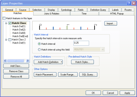
This is the Hatch Definition view. Note that the hatch definition is highlighted in the hatch tree. 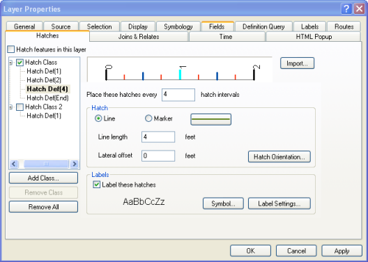
This is the End Hatch Definition view. Note that the end hatch definition is highlighted in the hatch tree.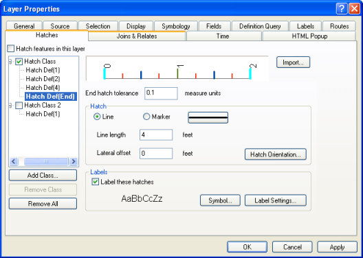
This is the Hatch Placement Options dialog box. 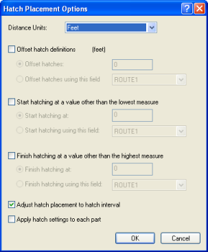
Learn more about displaying hatches