 |
This document is archived and information here might be outdated. Recommended version. |
IUniqueValueRenderer.Field Property (ArcObjects .NET 10.4 SDK)
 |
This document is archived and information here might be outdated. Recommended version. |
| ArcObjects namespaces > Carto > ESRI.ArcGIS.Carto > Interfaces > IU > IUniqueValueRenderer Interface > IUniqueValueRenderer.Field Property (ArcObjects .NET 10.4 SDK) |
Field at the specified index that is used to categorize features.
[Visual Basic .NET]
Public Function get_Field ( _
    ByVal Index As Integer _
) As String
[Visual Basic .NET]
Public Sub set_Field ( _
    ByVal Index As Integer, _
    ByVal Field As String _
)
[C#]
public string get_Field (
    int Index
);
[C#]
public void set_Field (
    int Index,
    string Field
);
[C++]
HRESULT get_Field(
  long Index,
  BSTR* Field
);
[C++]
HRESULT put_Field(
  long Index,
  BSTR Field
);
[C++]

Parameters
Index [in]
  Index is a parameter of type long
Field [out, retval]
  Field is a parameter of type BSTR
Index [in]
  Index is a parameter of type long
Field [in]
  Field is a parameter of type BSTR
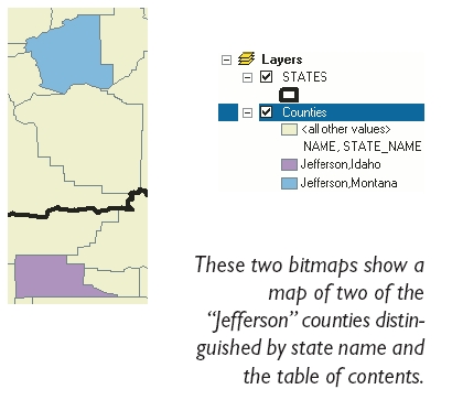
Specifying more than one field is valuable when a feature is ambiguous in the categories defined by just one field. For example, in the United States "Jefferson" is a common county name. If you are making a map of the counties of the United States, you might choose to define your unique values symbolization based on two fields: county name and state name.
