|
This document is archived and information here might be outdated. Recommended version. |
IGeometryServer2.ConvexHull Method (ArcObjects .NET 10.8 SDK)
|
This document is archived and information here might be outdated. Recommended version. |
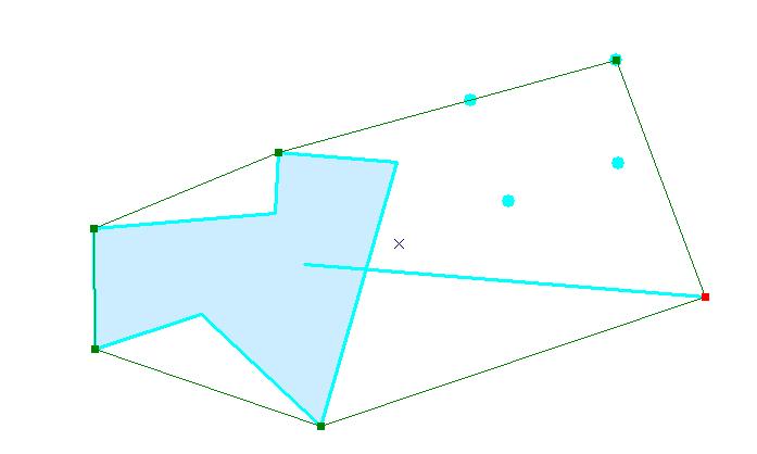
Computes the convex hull of the input geometries
[Visual Basic .NET]
Public Function ConvexHull ( _
    ByVal pSR As ISpatialReference, _
    ByVal pInGeometryArray As IGeometryArray _
) As IGeometry
[C#]
public IGeometry ConvexHull (
    ISpatialReference pSR,
    IGeometryArray pInGeometryArray
);
[C++]
HRESULT ConvexHull(
  ISpatialReference* pSR,
  IGeometryArray* pInGeometryArray
);
[C++]
Parameters
pSR

  pSR is a parameter of type ISpatialReference*
pInGeometryArray

  pInGeometryArray is a parameter of type IGeometryArray*
The convex hull of a set of points, polylines and polygons is shown below. If all the inputs are collinear, than a polyline will be returned instead of a polygon. If all inputs are located at a single point, then that point will be returned.