This document is archived and information here might be outdated.  Recommended version.


IPoint Interface (ArcObjects .NET 10.8 SDK)
ArcObjects Help for .NET developers > ArcObjects Help for .NET developers > ArcObjects namespaces > Geometry > ESRI.ArcGIS.Geometry > Interfaces > IP > IPoint Interface
ArcGIS Developer Help

IPoint Interface

Provides access to members that define two dimensional points.

Product Availability

Available with ArcGIS Engine, ArcGIS Desktop, and ArcGIS Server.

Description

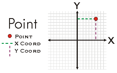
A Point is a zero-dimensional object that represents a specific (X, Y) location in a the two-dimensional XY-Plane.  A Point may also have Z, M, and ID attributes associated with it.  Existence of attributes does not alter the dimensionality of a Point nor does it alter geometric calculations performed on the Point.  Attributes are only considered for attribute calculations when the Point is ZAware, MAware, or PointIDAware.  Points may be constructed using PutCoords, individually setting the X and Y properties, or using the IConstructPoint interface.

Members

Name Description
Method Compare Compares X, Y, M, Z, ID of this point (in that order) with that of the other point. Returns -1 if this point's value is less, 1 if greater, and 0 otherwise. Useful for sorting a group of points.
Method ConstrainAngle Projects this point to the point on the infinite line defined by anchor and angle (in radians). If allowOpposite is true, then the point can also snap to angle + pi radians.
Method ConstrainDistance Projects this point to the perimeter of the circle defined by radius and anchor.
Read-only property Dimension The topological dimension of this geometry.
Read-only property Envelope Creates a copy of this geometry's envelope and returns it.
Read-only property GeometryType The type of this geometry.
Method GeoNormalize Shifts longitudes, if need be, into a continuous range of 360 degrees.
Method GeoNormalizeFromLongitude Normalizes longitudes into a continuous range containing the longitude. This method is obsolete.
Read/write property ID The Point ID attribute.
Read-only property IsEmpty Indicates whether this geometry contains any points.
Read/write property M The measure attribute.
Method Project Projects this geometry into a new spatial reference.
Method PutCoords Sets the X and Y coordinates.
Method QueryCoords Returns the X and Y coordinates.
Method QueryEnvelope Copies this geometry's envelope properties into the specified envelope.
Method SetEmpty Removes all points from this geometry.
Method SnapToSpatialReference Moves points of this geometry so that they can be represented in the precision of the geometry's associated spatial reference system.
Read/write property SpatialReference The spatial reference associated with this geometry.
Read/write property VertexAttribute Any attribute (coordinate), except X or Y.
Read/write property X The X coordinate.
Read/write property Y The Y coordinate.
Read/write property Z The Z attribute.

Inherited Interfaces

Interfaces Description
IGeometry Provides access to members that describe properties and behavior of all geometric objects.

Classes that implement IPoint

Classes Description
Point A two dimensional point, optionally with measure, height, and ID attributes.

Remarks


Point Example

See Also

IGeometry Interface | IMultipoint Interface | IConstructPoint Interface

.NET Samples

Angle Angle shape constructor Move a graphic along a path in ArcMap Move a graphic along a path in ArcMap Clonable object Find the closest intersection from a point Configure a command for a specific locale Controls commands environment Custom map navigation commands Custom map navigation commands Custom map navigation commands Custom map navigation commands Custom map navigation commands Custom map navigation commands Custom map navigation commands Custom scene navigation commands Custom scene navigation commands Custom scene navigation commands Custom scene navigation commands Custom scene navigation commands Custom scene navigation commands Custom scene navigation commands Custom scene navigation commands Custom scene navigation commands Custom scene navigation commands Custom map selection commands Dynamic biking Dynamic display animated zoom Dynamic display animated zoom Dynamic logo Buffer snap agent Tabbed feature inspector Custom vertex editing commands Edit event listener Export any network analysis class to a text file Find an address Create custom move, rotate, and scale GeometricEffects within a single project Create custom move, rotate, and scale GeometricEffects within a single project Navigating around the GlobeControl 3D dynamic element tracking Globe Fly tool Creating a toolbar of globe tools Creating a toolbar of globe tools Creating a toolbar of globe tools Draw text on a MapControl Geoevents in a MapControl Building a MapViewer application using the ArcGIS Engine controls Create a custom marker placement for placing markers around a point 3D multipatch examples 3D multipatch examples 3D multipatch examples 3D multipatch examples 3D multipatch examples 3D multipatch examples Simple dynamic display application Dynamic display layer Points along line construction tool Points along line construction tool RSS weather GraphicTracker RSS weather layer RSS weather layer RSS weather layer Implementing the ISchematicRulesHelper to easily develop a custom schematic rule Implementing a schematic digitizing tool Reducing schematic nodes and computing a cumulative attribute via a schematic rule Implementing an XML builder external component Custom selection extension Create a custom selection extension by extending ArcObjects Single line address geocoding StreetMap routing Custom subtyped command and tool Add map surrounds using the SymbologyControl Add map surrounds using the SymbologyControl Add map surrounds using the SymbologyControl Control text symbols using the SymbologyControl Tabbed feature inspector Triangle graphic element Triangle graphic element ViperPin tool ViperPin tool Visualizing the camera path while animating