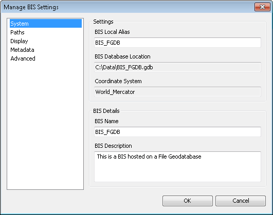
You can modify your active Bathymetry Information System (BIS) connection settings using the Manage BIS Settings tool. This tool allows you to change the BIS local alias and modify implementation details stored in the BisDetails table within the BIS geodatabase.
- Start ArcMap.
- On the main menu, click Customize > Toolbars > Bathymetry.
-
Click the Manage BIS Settings button
 on the Bathymetry toolbar.
The Manage BIS Settings dialog box appears. The settings for your active BIS geodatabases are shown in the dialog box. The location of the BIS database and coordinate system were set when the BIS geodatabase was created and are read-only and cannot be changed.

- Ensure that the System pane is active.
- In the Settings section, type a new alias name for the active BIS geodatabase in the BIS Local Alias text box.
- If you are an administrator and need a new name for the BIS geodatabase, type a new name in the BIS Name text box in the BIS Details section.
This updates the name of the BIS internally but does not change the name of the database itself or modify the database connection. The BIS Name value is stored within the BIS geodatabase and is defined by the BIS administrator; if you are not an administrator, it is highly recommended that you do not alter it.
- Type a new description in the BIS Description text box.
- Haga clic en Aceptar.
Your updated BIS geodatabase settings are saved.