ArcGIS for Maritime: Bathymetry allows you to retire existing metadata fields when they are no longer required. Retired metadata fields are never hidden from the user interface, but remain in your metadata schema and can be restored at any time.
The following steps demonstrate how to retire a metadata field in the collection metadata, but you can follow these steps to retire a field in the extended metadata.
If you use multiple BIS geodatabases that require custom metadata, you will need to make changes for each of those BIS geodatabases individually.
If you need to make major configuration changes to your collection or extended metadata schema, it is recommended that you make a backup copy of the schemas so that you can revert to your previous configuration if necessary. The location of your current metadata schema can be found in the Paths pane on the Manage BIS Settings window.
- Inicie ArcMap.
- Click Customize > Toolbars > Bathymetry on the main menu to activate the Bathymetry toolbar if necessary.
-
Click the Manage BIS Settings button
 on the Bathymetry toolbar.
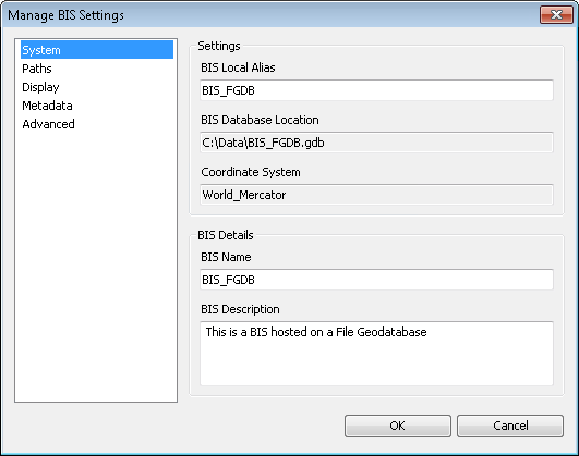
The Manage BIS Settings dialog box appears. The settings for your active BIS geodatabase are shown in this dialog box.

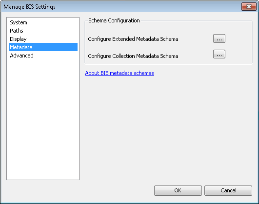
- Click Metadata.

- Click the ellipsis button (…) next to the metadata schema that contains the field you want to retire.
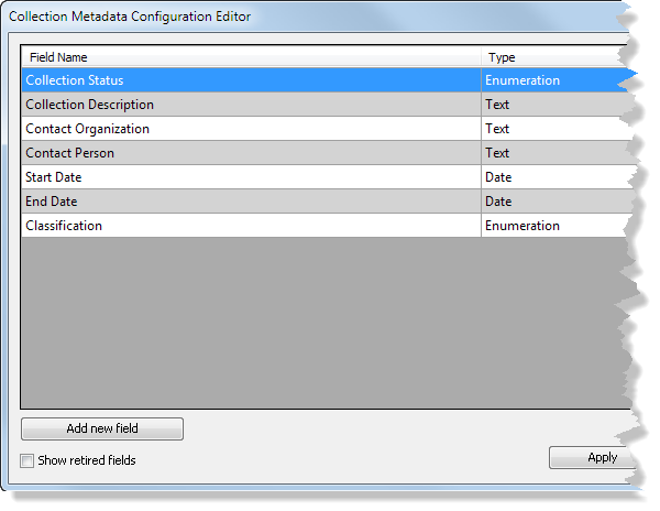
The Metadata Configuration Editor dialog box appears.

This example uses the collection metadata schema.
-
Right-click the field you want to retire and click Retire.
Even if your field was previously marked as searchable, it will no longer appear in the Manage Collections and Add Bathymetry dialog boxes or the Explore Bathymetry and Compose Surface windows.
- Click OK to save and close the Metadata Configuration Editor dialog box.
Although the metadata configuration editor updates immediately, you need to close and restart ArcMap for the schema changes to be reflected in other dialog boxes and windows in ArcMap.
- Close ArcMap.
- Inicie ArcMap.
The fields you retired are no longer displayed in the Manage Collections and Add Bathymetry dialog boxes or the Explore Bathymetry and Compose Surface windows.