Esri Roads and Highways supports 3D elevation data on route and centerline vertices. The centerline should be enabled to store z-values for each vertex. These z-values are used to store elevation data and can be used to calculate 3D measure values when calibrating routes in the network depending on the calibration method you choose. Since centerlines make up the routes in the network feature class, the network is also enabled to store z-values.
To populate the z-values on a centerline being used to create a route or edited during cartographic realignment, either add the values manually using the ArcMap editing tools or configure a raster dataset, such as a Digital Terrain Model (DTM) or Digital Elevation Model (DEM), with your LRS to automatically populate the values.
Adding z-values to centerlines using editing tools
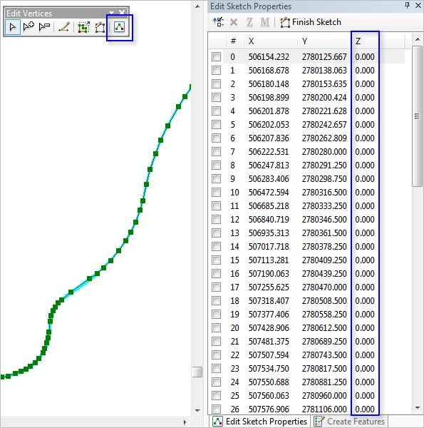
When digitizing a new or editing an existing centerline feature, z-values can be added or edited by opening the sketch properties for the feature and populating the z-values for each vertex on the feature.

Adding z-values to centerlines using a raster dataset
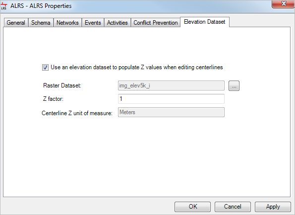
A raster dataset, such as a DTM or DEM, can be configured with your LRS to populate the z-values on newly digitized or edited centerlines in Roads and Highways.
Learn more about configuring a raster dataset in your LRS
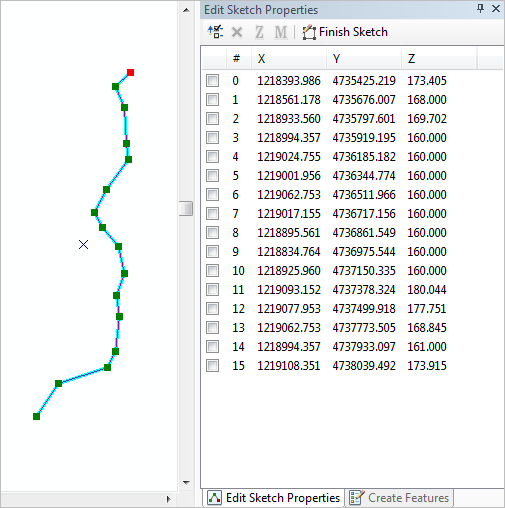
When a raster dataset is configured with your LRS, any digitized or edited centerline has z-values automatically applied based on the value of the raster dataset at that location.

In the example above, a newly digitized centerline with a raster dataset is configured with the LRS. The z-values are automatically applied based on the raster dataset.
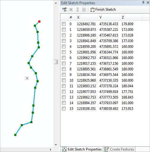
In the following example, the same centerline that has been edited. The location of the first four vertices has changed and the z-values were automatically updated based on the raster dataset.
