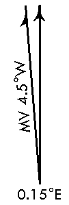
On airport diagrams, aerodrome charts, and some instrument approach procedures (IAPs), magnetic north arrows appear in the layout. These arrows provide directional awareness and depict the orientation of True North, magnetic variation, and grid variation for a particular airport. The arrows consist of two main types of elements: a magnetic variation arrow and a magnetic and grid variation arrow. These arrows are drawn based on the airport's coordinates or the center of the data frame using the World Magnetic Model.

- Inicie ArcMap.
- Ensure that the correct product library and production database are set.
- Check out the product to which you want to add an aviation north arrow.
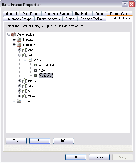
- Ensure that your chart's data frame is set to the appropriate
instance by right-clicking the data frame, selecting Properties,
and clicking the Product Library tab.

- On the main menu, click View > Layout View.
- On the main menu, click Customize > Toolbars > Aviation Layout.
- Ensure that the ADHP feature class is in the table of contents.
- Click the Aviation North Arrow button
 on the Aviation Layout toolbar.
The aviation north arrow is added to the chart.