Disponible con licencia de Production Mapping.
The Segment Distance function creates a segment based on two input coordinates and a specified distance. The segment can be used to represent a distance that extends from the first coordinate, though it may not necessarily connect with the second coordinate.

- Inicie ArcMap.
- On the menu bar, click Customize > Toolbars > Production Feature Builder.
- Click the Feature Builder button
 on the Production Feature Builder toolbar.
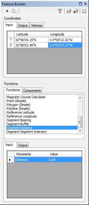
The Feature Builder window appears.
- Choose Segment Distance in the list on the Functions tab.

- Define a coordinate for the start point of the polyline by doing one of the following:
- Click the Pinprick tool
 on the Production Feature Builder toolbar and click the map
 - Type the coordinates in the cells on the Input tab in the Coordinates area.
- Click the Pinprick tool
- Repeat step 5 to define a coordinate for the end point of the segment.
- Click the cell next to Distance and type a value.
This is the distance the segment is going to extend from the first coordinate. The default unit is Nautical Miles.
- Click the Execute button
 .
.
Depending on the locations of the two coordinates and the distance specified, the resulting segment may not connect the two coordinates.