Once you have created at least one BIS geodatabase, you can link bathymetry data to the BIS geodatabase and associate metadata to the bathymetry data. For fields that you previously added to your metadata schema, ArcGIS for Maritime : Bathymétrie allows you to add new values to the list of possible values. This list will append the new values to a drop-down menu in dialog boxes and windows such as the Explore Bathymetry window. This is only applicable to any enumerated value field types you may have. This can be useful when needing to add extra sensor types to a field that lists sensors or names to a field that lists names of all captains for a particular survey vessel. The added advantage of an enumerated value field is that it allows you to designate pre-defined text values, which can then be chosen from a drop-down menu.
The following steps provide an example of how to add an item to the vessel field, which shows up as a drop-down menu within the Explore Bathymetry window. These steps can be applied to any extended or collection metadata drop-down menu that displays in the Add Bathymetry and Manage Collections dialog boxes and the Explore Bathymetry and Compose Surface windows.
Ideally, you should add the new item before associating a bathymetry dataset with a BIS geodatabase. However, if you want this new item to appear as an option in the drop-down menu for datasets already associated with the BIS geodatabase, you will need to use the Edit Metadata tool accessible from the Explore Bathymetry window to define it.
If you use multiple BIS geodatabases that require custom metadata, you will need to make changes to the metadata files for each of those BIS geodatabases individually.
In the event that you need to make any major configuration changes to either your collection or extended metadata schema, it is recommended that you make a backup copy so you can revert to your prior configuration if necessary. The location of your current metadata schema can be found on the Paths pane.
- Start ArcMap.
- On the main menu, click Customize > Toolbars > Bathymetry.
-
Click the Manage BIS Settings button
 on the Bathymetry toolbar.
The Manage BIS Settings dialog box appears. The settings for your active BIS geodatabase are shown in the dialog box.
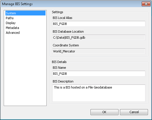
- Click the Metadata pane.
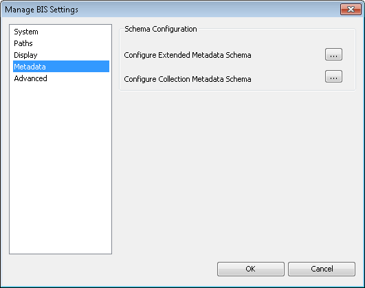
- Click the ellipsis button (…) next to the appropriate field to configure the schema for either the extended or collection metadata.
The Extended Metadata Configuration Editor or Collection Metadata Configuration Editor dialog box appears.
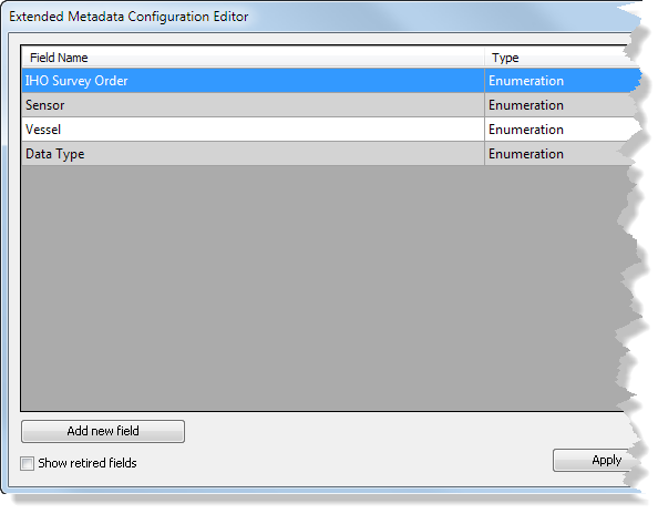
In this example, we use the extended metadata schema.
-
Right-click the enumerated field to which you want to add an item and click Edit.
In this example, we use the Vessel field.
The Edit Metadata Field dialog box appears. All the metadata values currently associated with your enumeration field are listed.
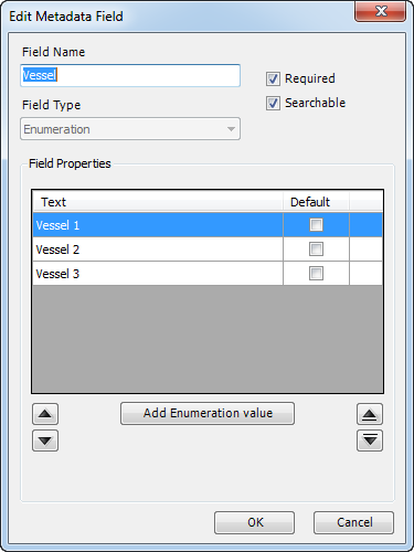
- Click Add Enumeration value to add a new item or enumeration value.
This will add another row to the display and allow you to customize the text for that field value.
- Type the name of the new field value in the Text column.
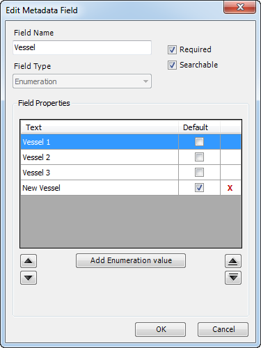
- You can check the Default check box if you want the field to automatically be populated with the new value any time a new dataset is added.
- Click OK to save the changes or additional enumeration values you have added.
- Click OK to save and close the metadata configuration editor.
Although the metadata configuration editor will update immediately, for the schema change to be reflected in other dialog boxes and windows where this field is visible, such as the Manage Collections and Add Bathymetry dialog boxes and the Explore Bathymetry and Compose Surface windows, you will need to close and restart ArcMap to see the applied changes.
- Close ArcMap.
- Start ArcMap.
-
Click the Explore Bathymetry button
 on the Bathymetry toolbar.
The Explore Bathymetry window appears. The right side of the window lists all the unfiltered bathymetry datasets from the active BIS geodatabase.
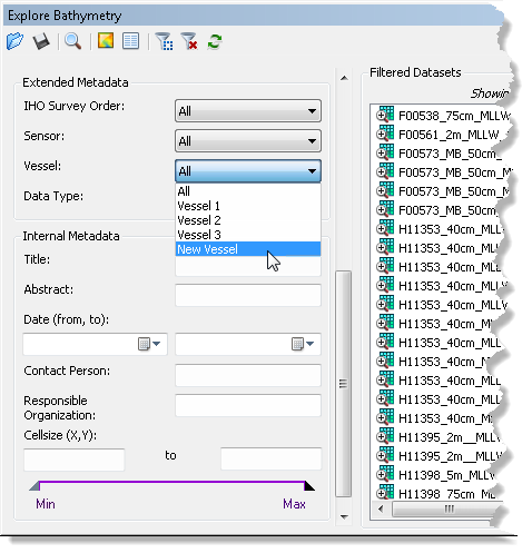
- Click the Vessel drop-down arrow.
The new vessel item is listed as an option.