Data Interoperability のライセンスで利用可能。
The Quick Export tool converts geodatabase feature classes or feature layers to any external dataset supported by the Data Interoperability extension using a one-to-one translation. This tool is ideal for exporting data to nonnative datasets when your workflow does not require feature geometry or schema to be modified.
In this exercise, export geodatabase zoning data to a MapInfo TAB dataset.
Using the Quick Export dialog box, perform the following tasks:
- Specify the geodatabase data source.
- Choose the FME writer and specify the data destination.
- Accept the default writer parameters.
- Accept the coordinate system defined by the data source.
- Export the data.
After exporting the data, add the dataset to ArcMap to verify your results.
Open the tool and specify input
前提条件:
The Data Interoperability extension must be enabled.
Before starting this exercise, you must have completed the previous exercise, Exercise 2a: Importing data with the Quick Import tool.
- Start ArcMap.
- Click Catalog
 on the Standard toolbar.
-
Find and open the Quick Export tool using the Search window
 .
.
- Click the Input Layer browse button.
The Input Layer dialog box opens.
- Using the Look in drop-down menu, browse to C:\arcgis\ArcTutor\Data Interoperability\zoning\zoning.
- Click on zoning.gdb and click Add.
- Click on the zoning feature class and click Add.
The Input Layer dialog box closes.
Specify the output and run the tool
This exercise will be converting a Geodatabase to a Mapinfo TAB dataset using the geoprocessing tool Quick Export.
- Click the Output Dataset browse button.
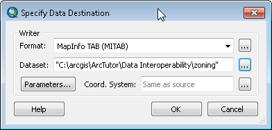
The Specify Data Destination dialog box opens.
Choosing the FME writer
- Click the Format browse button.
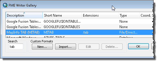
The FME Writer Gallery dialog box opens.

- Type tab in the Search text box.
- Click the row listing MapInfo TAB (MITAB) and click OK.
The FME Writer Gallery dialog box closes.
Specifying the data destination and running the tool
- Click the Dataset browse button.
The Select Folder dialog box opens.
- Browse to C:\arcgis\ArcTutor\Data Interoperability\zoning and click Select Folder.
The Select Folder dialog box closes and the Dataset text box is populated with the path. By default, the MapInfo TAB writer uses the input feature class name.

- Click OK.
The Specify Data Destination dialog box closes.
- Click OK.
The tool executes the conversion in the background. A progress bar at the bottom of your map displays the name of the tool. When the tool is finished, a pop-up notification appears in the system tray. You can examine the details of the conversion in the Results window.
Add the data to ArcMap
- Click the zoning folder in the Catalog window and press F5 to refresh the contents.
- Expand the new zoning.tab dataset in the Catalog window.
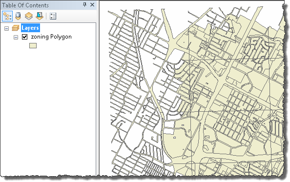
- Drag the zoning Polygon feature class onto the data frame and verify your results.

This completes the exercise.
Continue to the next exercise: Exercise 3a: Getting started with spatial ETL.