Краткая информация
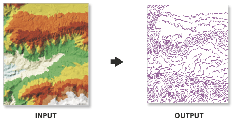
Generates contours from a TIN surface.
Иллюстрация

Использование
Use the interval and base contour options to tailor the extent and resolution of the output feature class.
Use the out contour field data to convert the feature class to 3D.
In certain instances the last valid contour line may not be produced when creating contours using TIN surfaces. This is an algorithmic limitation common to computer contouring software. To ensure that all valid contours are generated, add a very small negative value to the base contour field to slightly shift the data.
Синтаксис
TinContour_3d (in_tin, out_feature_class, interval, {base_contour}, {contour_field}, {contour_field_precision}, {index_interval}, {index_interval_field}, {z_factor})| Параметр | Объяснение | Тип данных |
in_tin | The surface from which the contours will be interpolated. | TIN Layer |
out_feature_class | The output feature class. | Feature Class |
interval | The interval between the contours. | Double |
base_contour (Дополнительный) | Along with the index interval, the base height is used to determine what contours are produced. The base height is a starting point from which the index interval is either added or subtracted. By default, the base contour is 0.0. | Double |
contour_field (Дополнительный) | The field containing contour values. | String |
contour_field_precision (Дополнительный) | The precision of the contour field. Zero specifies an integer, and the numbers 1–9 indicate how many decimal places the field will contain. By default, the field will be an integer (0). | Long |
index_interval (Дополнительный) | The difference, in Z units, between index contours. The value specified should be evenly divisible by the contour interval. Typically, it’s five times greater. Use of this parameter adds an attribute field to the output feature class that’s used to differentiate index contours from regular contours. | Double |
index_interval_field (Дополнительный) | The name of the field used to record whether a contour is a regular or an index contour. By default, the value is ‘Index’. | String |
z_factor (Дополнительный) | Specifies a factor by which to multiply the surface heights. Used to convert z units to x and y units. | Double |
Параметры среды
Информация о лицензиях
- ArcGIS Desktop Basic: Требует 3D Analyst
- ArcGIS Desktop Standard: Требует 3D Analyst
- ArcGIS Desktop Advanced: Требует 3D Analyst