摘要
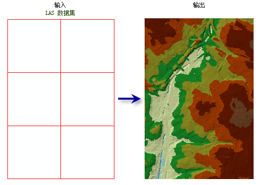
通过 LAS 数据集导出不规则三角网 (TIN)。
插图

用法
-
将 LAS 数据集指定为输入时,将处理它引用的 LAS 文件中的所有数据点。也可以按分类代码、分类标记和回波值来选择激光雷达数据的子集,方法是在 LAS 数据集图层中应用所需的 LAS 点过滤器。可通过图层属性对话或创建 LAS 数据集图层工具定义过滤器。
-
LAS 数据集图层还可用于控制表面约束要素的强化,而该要素可由 LAS 数据集引用。
若要以更强的预测能力控制 LAS 点在生成输出 TIN 过程中的细化方式,请考虑使用窗口大小细化类型(Python 中为 thinning_type = "WINDOW_SIZE")。
语法
LasDatasetToTin_3d (in_las_dataset, out_tin, {thinning_type}, {thinning_method}, {thinning_value}, {max_nodes}, {z_factor})| 参数 | 说明 | 数据类型 |
in_las_dataset | 待处理的 LAS 数据集。 | LAS Dataset Layer |
out_tin | 将要生成的 TIN 数据集。 | TIN |
thinning_type (可选) | 指定用于选择可导出至 TIN 的 LAS 数据点子集的技术。
| String |
thinning_method (可选) | 指定用于减少 LAS 数据点的技术,该技术将对细化值的解释产生影响。可用选项取决于所选的细化类型。
指定用于减少 LAS 数据点的技术,该技术将对 thinning_value 的解释产生影响。可用选项取决于所选的 thinning_type。
| String |
thinning_value (可选) | 如果选择 thinning_type = "WINDOW_SIZE",该值表示将要划分 LAS 数据集的采样区。 如果选择 thinning_type = "RANDOM" 和 thinning_method = "PERCENT",该值表示要被导出到 TIN 的 LAS 数据集的点百分比。 如果选择 thinning_type = "RANDOM" 和 thinning_method = "NODE_COUNT",该值表示可被导出到 TIN 的 LAS 点的总数。 | Double |
max_nodes (可选) | 输出 TIN 中允许的结点的最大数量。默认值为 5 百万。 | Double |
z_factor (可选) | Z 值将乘上的系数。此值通常用于转换 Z 线性单位来匹配 XY 线性单位。默认值为 1,此时高程值保持不变。 | Double |
代码示例
LasDatasetToTin 示例 1(Python 窗口)
下面的示例演示了如何在 Python 窗口中使用此工具。
import arcpy
from arcpy import env

arcpy.CheckOutExtension('3D')
env.workspace = 'C:/data'

arcpy.LasDatasetToTin_3d('se_baltimore.lasd', 'se_bmore', 'RANDOM', 15, 3.28)
LasDatasetToTin 示例 2(独立脚本)
下面的示例演示了如何在独立 Python 脚本中使用此工具。
'''**********************************************************************
Name: LAS Dataset to TIN Example
Description: Create a TIN using bare earth lidar measurements. This
             script is designed for use as a script tool.
**********************************************************************'''
# Import system modules
import arcpy
import exceptions, sys, traceback

# Set Local Variables
lasD = arcpy.GetParameterAsText(0)
inLas = arcpy.GetParameterAsText(1) #input las files
surfCons = arcpy.GetParameterAsText(2) #input surface constraints
sr = arcpy.GetParameter(3) #spatial reference of las dataset
outTin = arcpy.GetParameterAsText(4)
thinningType = arcpy.GetParameterAsText(5)
thinningMethod = arcpy.GetParameterAsText(6)
thinningValue = arcpy.GetParameter(7)
zFactor = arcpy.GetParameter(8)

try:
    arcpy.CheckOutExtension('3D')
    # Execute CreateLasDataset
    arcpy.management.CreateLasDataset(inLas, lasD, 'RECURSION', surfCons, sr)
    lasLyr = arcpy.CreateUniqueName('lasdToTin', 'in_memory')
    classCode = 2
    returnValue = 'LAST'
    # Execute MakeLasDatasetLayer
    arcpy.management.MakeLasDatasetLayer(lasD, lasLyr, classCode, returnValue)
    # Define extent of the area of interest
    env.extent(1426057, 606477, 1449836, 623246)
    # Execute LasDatasetToTin
    arcpy.ddd.LasDatasetToTin(lasLyr, outTin, thinningType,
                              thinningMethod, thinningValue, zFactor)
    arcpy.CheckInExtension('3D')
except arcpy.ExecuteError:
    print arcpy.GetMessages()
except:
    # Get the traceback object
    tb = sys.exc_info()[2]
    tbinfo = traceback.format_tb(tb)[0]
    # Concatenate error information into message string
    pymsg = 'PYTHON ERRORS:\nTraceback info:\n{0}\nError Info:\n{1}'\
          .format(tbinfo, str(sys.exc_info()[1]))
    msgs = 'ArcPy ERRORS:\n {0}\n'.format(arcpy.GetMessages(2))
    # Return python error messages for script tool or Python Window
    arcpy.AddError(pymsg)
    arcpy.AddError(msgs)
环境
许可信息
- ArcGIS Desktop Basic: 需要 3D Analyst
- ArcGIS Desktop Standard: 需要 3D Analyst
- ArcGIS Desktop Advanced: 需要 3D Analyst