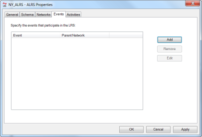
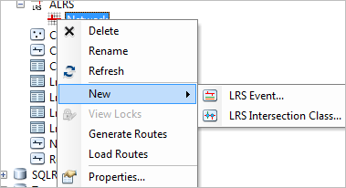
Events are registered with Esri Roads and Highways in the ALRS Properties dialog box or by right-clicking the LRS Network in the Catalog window.


Events within the geodatabase and external events
Esri Roads and Highways has two types of events: those stored within the same geodatabase as the LRS and those in external databases. Events within the geodatabase are stored as feature classes. To use the relocate events web services to send updates to external events, those events must be in an RDBMS database/geodatabase. Besides the location of the source table, internal and external events also have a major difference with respect to how they are managed after registration.
Events within the geodatabase
Events within the same geodatabase as the LRS are managed as feature classes. Esri Roads and Highways manages the shape of the event features based on the route, measure, and to and from dates. This provides increased performance in ArcGIS for mapping and spatial query of the event data. When registering an event that will be within the same geodatabase as the LRS, you can model the feature class in advance within the geodatabase with the LRS, have Esri Roads and Highways create the new feature class for you within the geodatabase with the LRS, or copy the schema from another table or feature class to the new feature class created within the geodatabase as the LRS. Once an event is registered with Esri Roads and Highways, any existing event records can be loaded using the Append Events tool. For more information on events in the LRS geodatabase, see Registering an event within the LRS geodatabase.
Once an event within the geodatabase is registered, Esri Roads and Highways will manage the event moving forward. When edits made to a route have an impact on event measures via the event measure behavior configuration, the changes are made directly to the event feature class. When the event layer is refreshed in your map, which is automatically triggered by the Esri Roads and Highways edit activity, you can see the updates immediately.
External events
Roads and Highways connects to external event tables, not modeled in the geodatabase, in read-only fashion. When an event table or feature class outside the geodatabase with the LRS is registered as an external event table, the LRS assumes a read-only connection and never writes changes directly to the event table. There may be business rules associated with updating measures on events in an external system, so Roads and Highways does not directly modify events in external systems. For more information on external events, see Registering an external event source.
Roads and Highways does keep a log of all the edits performed that have an impact on event measures. Using web services, these updates can be sent to the external table or feature class so the measure updates can be applied. For more information about sending updates to external events, see Deploying the Relocate Event tool as a service.
Referent offset events
Esri Roads and Highways supports referent offsets being used to manage the location of events. When registering an event within the geodatabase with the LRS, you specify a route ID and measure columns to inform Roads and Highways how to locate the events on the network. If your events also have referent columns configured, you can locate events based on an offset from the location of another entity. In some cases, that entity could be another event, point feature class, or x,y coordinates. For more information on referent offset events, see Storing referent and offset information for event location.