适用于 Location Referencing 许可。
ArcGIS Pipeline Referencing provides a GIS-enabled, linear referencing data management solution for pipeline organizations. It supports the following:
- LRS information model
- Network and event loading tools
- Network editing
- Event editing
- Geoprocessing tools
- Web services
LRS information model
To use Pipeline Referencing, you must have your data in the required information model in the geodatabase. Pipeline Referencing has an information model for linear referencing system (LRS) networks (routes) and a flexible information model for LRS events that allow you to model your own event feature classes.
Pipeline Referencing provides the ability to edit and maintain LRS networks and associated event data. It also supports updating event measures and route associations based on changes to the LRS network.
Before using Pipeline Referencing tools, it is recommended that you read the information on the basic concepts behind the LRS network and LRS events information model. These concepts will not only aid in understanding the data loading process, but will also set the foundation for how to use the tools.
Utility and Pipeline data model
Esri also provides a data model called the Utility and Pipeline Data Model (UPDM), with predefined feature classes for events and features in the pipeline network. The UPDM linear referencing and event model is based on the information model used by Pipeline Referencing .
With Pipeline Referencing, you have the flexibility to define your own event data model or use the UPDM. You can get Pipeline Referencing up and running much faster by using the Create UPDM Geodatabase tool available on GitHub to expedite data configuration.
If you want to load your data into the UPDM, use the Create UPDM Geodatabase tool, available on GitHub, to create the geodatabase and preconfigure it for use with Pipeline Referencing. You can create the UPDM schema in a file geodatabase and load all the required data. Once the data is loaded, you can migrate your linear referencing system (LRS) to an enterprise geodatabase. For more information, see Migrating an LRS from a file geodatabase to a multiuser geodatabase.
If you want to model your own LRS geodatabase without using the Create UPDM Geodatabase geoprocessing tool, you can go through the following process to model your own Pipeline Referencing-compatible model:
- Create and modify an LRS.
- Create and modify LRS events.
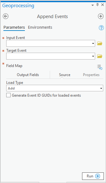
- Load event data with the Append Events geoprocessing tool.
LRS network and event loading
The modeling, creation, and configuration of the Pipeline Referencing for Desktop LRS, networks, and events, including route and event loading, are managed in ArcGIS Pro geoprocessing tools. For more information, see Create the LRS, networks, and events.
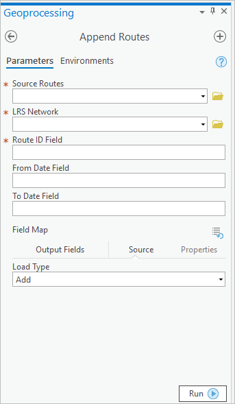
Use the Append Routes geoprocessing tool to load routes. With this tool, both continuous and engineering networks can be loaded.

Use the Append Events geoprocessing tool to load events. With this tool, both event tables and event feature classes can be loaded.

LRS network editing
To edit LRS networks, you must use the Location Referencing tab that is part of Pipeline Referencing. This tab supports editing the Pipeline Referencing information model elements used to build an LRS network. On this tab, you can create, realign, reassign, retire, extend, and cartographically realign routes. You can also edit calibration points and centerlines. You can't edit LRS route directions, but you can use these tools to apply edits to the LRS routes. To create, extend, or realign a route, you must use the Choose Centerline tool to select the centerlines that participate in the operation. The Location Referencing tab is context based; it is available only when you have Pipeline Referencing features for route editing (that is, routes, calibration points, and centerlines) added to your 2D map.
Pipeline Referencing features (routes, events, calibration points, and intersections) are modeled to support time (they are time aware). If you are configuring maps for editing networks, it is recommended that you configure time support for each of these layers in the map.
LRS event editing
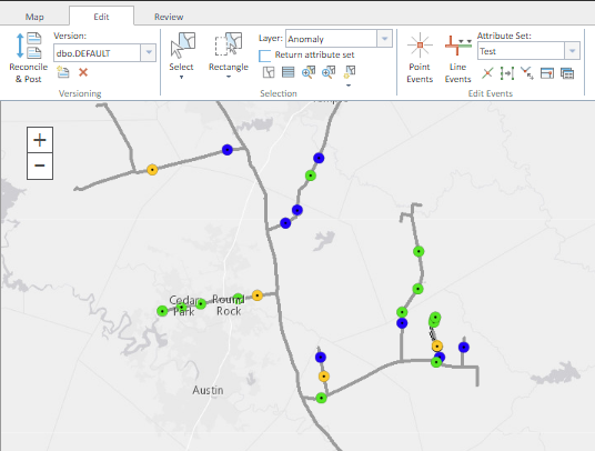
Pipeline Referencing supports event editing through the Event Editor web app.
This web app is powered by Pipeline Referencing for Server.

Event Editor has the following available features:
- Route search—Locates routes on the map.
- Attribute set—Defines groups of event layers and named attribute sets to provide attributes across multiple event layers in a single transaction for a given route and to and from measure pairs. The event layers can also be stored and referenced in different linear referencing methods (LRMs). Event Editor provides route and measure translations across LRMs.
- Quality control checks—Runs quality control checks for a route to detect event data gaps, overlaps, and invalid measures. Event Editor then uses its editing capabilities to correct those errors.
- Event data query and editing—Queries for event data by route association, ad-hoc queries, spatial intersecting geometry, or location proximity. You can visualize, browse, and bulk edit the tabular results.
To deploy Event Editor, complete the following steps:
- Install ArcGIS Server.
- Install Location Referencing for Server.
- Deploy your LRS geodatabase to an enterprise geodatabase.
- Publish a map service from ArcMap that contains the event layers to edit via ArcGIS Server (enabling the Pipeline Referencing for Server linear referencing capability).
- Deploy Event Editor.
- Configure Event Editor configuration files: config.json and webmap.json.
LRS geoprocessing tools
Pipeline Referencing includes a suite of geoprocessing tools that support LRS data loading, processing, and transformations. These geoprocessing tools operate primarily against event feature classes.

LRS web services
Pipeline Referencing for Server extends the ArcGIS Server map service to provide linear referencing capability to your data as REST services. These capabilities include the following:
- Event editing
- Translating coordinates to measures
- Translating measures to coordinates
- Translating between measures systems
- Dynamically segmenting event layers
- Detecting gaps, overlaps, and invalid measures on events
For more information, see the following:
Quality control
Pipeline Referencing provides quality control (QC) checks for event data and the Event Editor web app. This allows your organization to continuously improve data quality and refine its pipeline data assets. In addition to these QC tools, you can also use ArcGIS Data Reviewer for Desktop, which is a feature set that extends the ArcGIS platform to check for and manage data errors. Pipeline Referencing for Desktop includes Data Reviewer.
For more information on Data Reviewer for Desktop, see What is Data Reviewer?
Workflow management
Pipeline Referencing for Desktop includes ArcGIS Workflow Manager, which can be used to coordinate data management in GIS and across business units to develop a standard, repeatable process for LRS data management within your organization.
For more information on ArcGIS Workflow Manager, see What is Workflow Manager?