When constructing or modifying route features, it is important to ensure that the updated alignment is correct and accurate. ArcGIS provides a number of tools for editing line geometry. ArcGIS Roads and Highways provides tools for incorporating the updated line work into the linear referencing system (LRS).
Edits to geometry can also be made outside of ArcGIS as shapefiles, and computer-aided design and drafting (CADD) files are supported in addition to ArcGIS feature classes. Centerline features must be polyline features.
Centerlines are selected using the Choose Centerlines tool on the Roads And Highways Editing toolbar.
- Start ArcMap and add an LRS Network and redline feature class to your map.
- Add the feature or feature layers you want to use for your centerlines.
- Start an edit session.
- On the Roads And Highways Editing toolbar, select a target LRS Network.
- Click the Choose Centerlines button
 on the Roads And Highways Editing toolbar.
- Choose one or more centerlines by pressing and holding the Shift key.
You can choose multiple centerlines for the create, extend, and realign route activities.
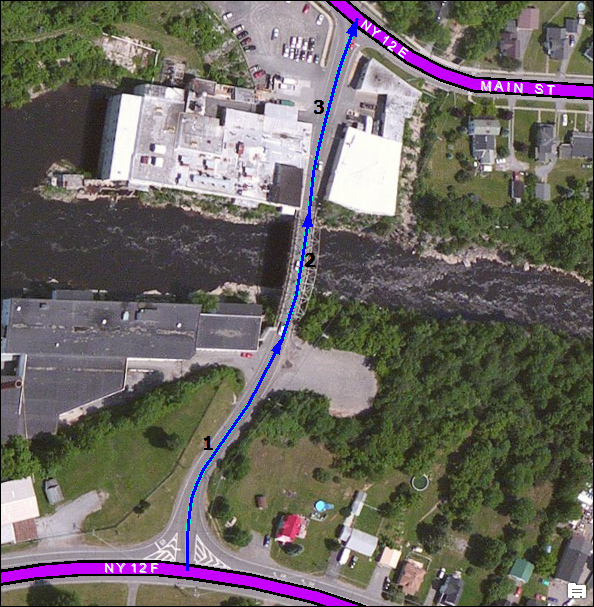
Pressing the Shift key allows you to define the order of the centerlines. The order in which the centerlines are selected determines the increasing direction of measure calibration. The direction of digitization of the centerline, depicted by the direction of the arrowhead on the selected centerline, also determines the direction of increasing measure calibration. To change the direction of calibration on a centerline, use the Flip Geometry command by right-clicking the selected centerline. This is helpful if you want to flip the current direction, for example, in a roundabout.
In this example, multiple centerlines are selected with their order and direction of calibration defined.
