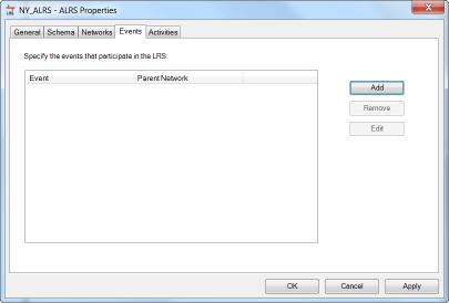
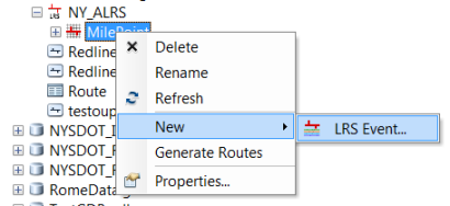
Events are created by registering event tables with Esri Roads and Highways in the ALRS Properties dialog box or by right-clicking the LRS Network in the Catalog window.

Internal and external event layers
Event layers are either internal, meaning they reside within the geodatabase that houses your ALRS, or external, which means they reside outside of the geodatabase. External events can be stored in another geodatabase, an Access database, a dBASE file (.dbf), an Excel spreadsheet, or in any other enterprise database, such as Oracle, SQL Server, and so forth. Besides the location of the source table, internal and external events also have a major difference with respect to how they are managed after registration.
Internal events
Internal events are managed in feature classes, called the event feature classes, in which Esri Roads and Highways manages the shape of the feature based on the route, measure, and to and from dates. This provides increased performance in ArcGIS for mapping and spatial query of the event data. When registering an internal event, you can register either a feature class or event table. If you register an event table, the data is copied into a feature class to support the storage of the shape on the event and from that point forward. If the table or feature class that is registered as an internal event has a subtype attached to it, then that subtype is copied over to the featurized event.
When edits made to the route have an impact on event measures via the event measure behavior configuration, the changes are made directly to the event feature class. When the event layer is refreshed in your map, which is automatically triggered by the Esri Roads and Highways edit activity, you can see the updates immediately.
External events
Roads and Highways connects to external event tables, not modeled in the geodatabase, in read-only fashion. When an event table is registered as an external event table, the ALRS assumes a read-only connection and never writes changes directly to the event table. There may be business rules associated with updating measures on events in an external system, so Roads and Highways does not directly modify events in external systems.
Reference offset events
Esri Roads and Highways supports registration of simple events and reference offset events. When registering events, you specify a route ID and measure columns to inform Roads and Highways how to locate the events on the network. When registering reference offset events, you locate events based on an offset from the location of another entity. In some cases, that entity could be another event, point feature class, or X- and Y-coordinates.
There are two different types of events that can be created: