New at 10.4.1
Address management
The address management tools for Roadway Characteristics Editor (RCE) have been moved to GitHub.
Roadway Characteristics Editor (RCE)
The following enhancements have been added to RCE:
- Support for geodatabase range domains
- Calculate a field in the attribute set results table
- Switch, create, and delete geodatabase versions
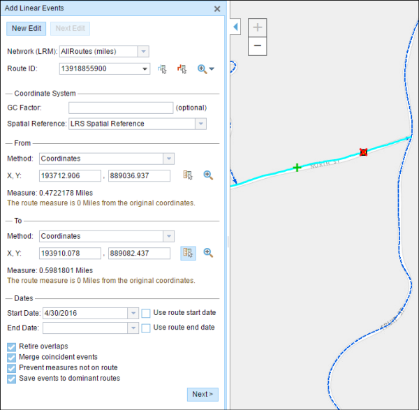
- Coordinate entry from From and To measures in the Add Linear Event widget
- The pan and zoom buttons are available all the time at the top bar
- Improved cell tabbing and text selection (for clipboard copy/paste) in the attribute and attributes set results tables
- Event ID is no longer required to edit events
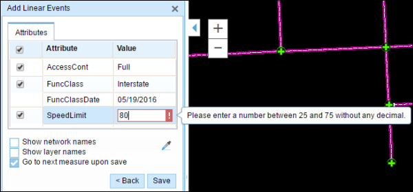
Range domains
Range domains configured for event fields within the geodatabase are now supported in the Add Linear Events widget, Add Point events widget, event attribute and attribute set tables. For events with range domains configured, entering a value outside the range won’t be able to be saved and will prevent invalid values from making it into your data.
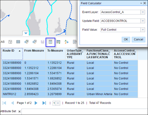
Calculating fields
When returning an attribute set, you can now calculate any editable field using a field calculator in the attribute set table. This is useful in cases where you want to make bulk updates to event attribute fields in more than one event layer within an attribute set.
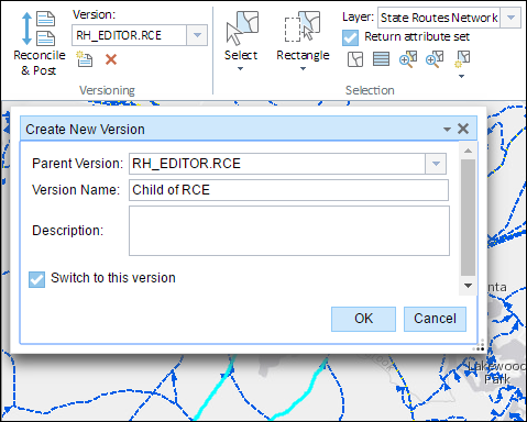
Geodatabase versions
With RCE, you can now switch between geodatabase versions as well as create and delete versions. If your editing workflows require moving between versions for editing, changing versions can now be accomplished by selecting the version you want to switch to in the versioning section of the Edit tab. Additionally, you can create and delete versions within your geodatabase, instead of having to open up ArcMap or ArcCatalog to make those changes.
Coordinate entry of From and To Measures in the Add Linear Event widget
If you collect or enter your linear events using coordinates, you can now use the Coordinates method in the Add Linear Events widget. Previously available in the Add Point Events widget, you can now enter new linear events using coordinates in the spatial reference of your choice. Additionally the coordinates entered will be saved as referents for your events if you configure your events to store referents.
Pan and zoom buttons
The pan and zoom buttons are now always available for use in navigating around the map in RCE. No matter which tab you select, you will always be able to select pan, zoom in, or zoom out to assist with your navigation as the buttons are always located in the top left corner of RCE.

Attribute and attributes set results tables
When editing in the event attribute and attribute set result tables, you can now use common keyboard shortcuts for copying (Ctrl+C) and pasting (Ctrl+V) values. In addition, you can also copy non-editable cell values, tab through rows, and use the arrow keys to navigate through cells in the table.
Roadway Reporter
When creating a Mileage Report in Roadway Reporter using events that span a physical gap in the route, mileage is calculated for both parts of the event on the physical gap. This ensures no additional mileage is added to your report in cases when the ends of the physical gap might have different measures.
New at 10.4
Roads and Highways Server
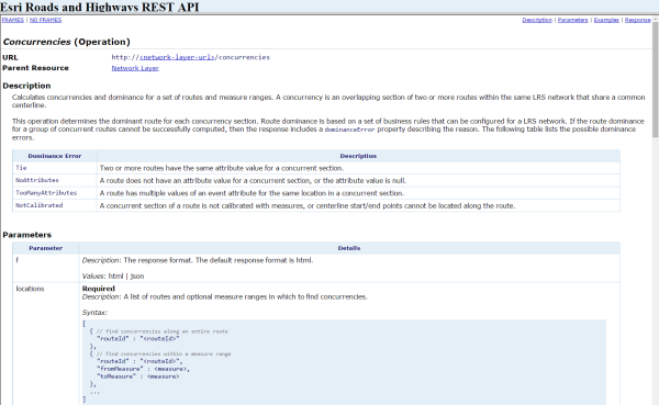
REST: Calculate concurrencies and dominant route for a set of routes and measure ranges
A new REST endpoint to support calculate concurrencies and determine the dominant route is available at 10.4. This endpoint supports inputting a list of routes and measure ranges and returning the concurrent sections and dominant route in each section based on dominance rules for the network.
Roadway Characteristic Editor
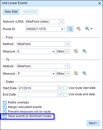
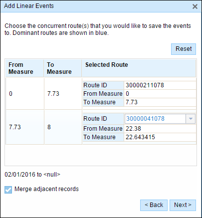
Add Point and Linear Events to dominant routes if a concurrency exists
When using Add Point Events and Add Linear Events widgets to add new events, you have the option to only add events to the dominant route in a section with concurrent routes. If enabled, any concurrent sections on the route selected will allow users to choose which route the events will be added to on each concurrent section. This option is available when the network selected has dominance rules configured. This is useful for users that only want events added to the dominant route in the network when using the Add Point Events and Add Linear Events widgets.
Add Point Events widget interface updates
The following updates have been added to the Add Point Events widget.
- Show X/Y Location check box has been removed
- Coordinate Sys has been replaced with Spatial Reference
Snap to multiple layers
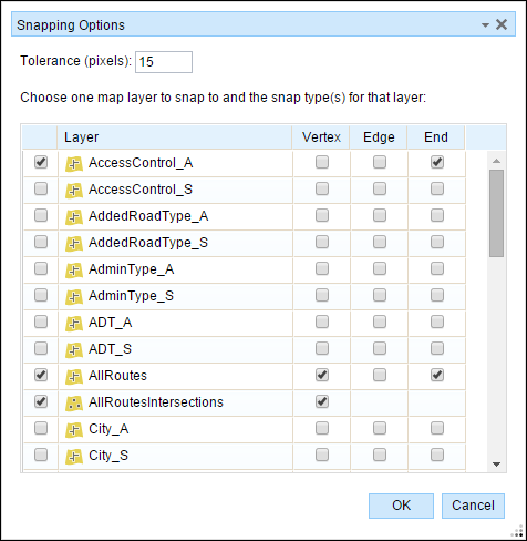
Users can now configure the Roadway Characteristics Editor to support snapping to multiple layers. Within snapping options in RCE, users can now check multiple layers and each will support snapping. The maximum number of layers that can support snapping in an RCE instance is set within the configuration file and can be changed for each RCE instance.
Roadway Reporter
Calculate and summarize mileages based on fields in the network
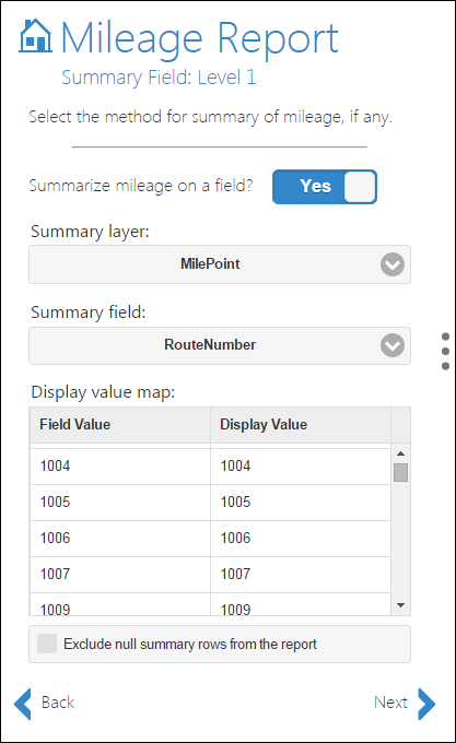
Fields from the LRS Network are now available for calculation and summary of mileage within the Mileage Report. When creating a report, the LRS Network will be included in the list of summary layers when configuring the summary field. This functionality is beneficial to users with a business need to report based on fields in the network feature class.
Calculate mileages for only the dominant route where a concurrency exists
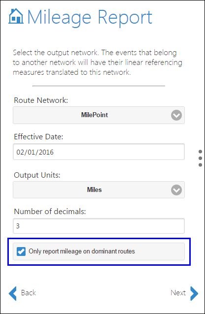
Mileage Reports can now be configured to only report mileage on the dominant route in locations where there are concurrent routes. This is useful for users with reporting needs requiring reporting mileage on dominant routes only.
Notification via email when a report for ready for viewing and downloading
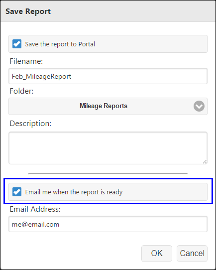
Users now have the ability to receive an email when their report is complete and ready to be viewed and downloaded. For large reports, you can now run the report then move onto other work and be notified when the report is finished and ready for viewing.
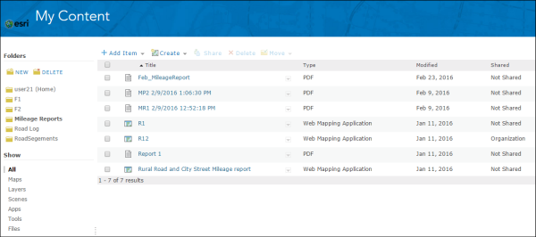
Save and share reports in PDF and CSV format on ArcGIS.com
Reports created within the Reporting Application can now be saved to ArcGIS.com. Once these reports are saved, they can accessed and shared with other users on ArcGIS.com.
