Mit der Geostatistical Analyst-Lizenz verfügbar.
You may be interested in mapping a trend, or you might want to remove a trend from the dataset when using kriging. The Trend Analysis tool can help identify trends in the input dataset.
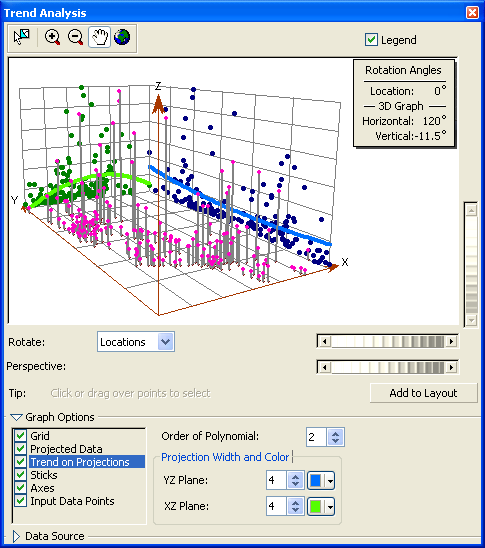
The Trend Analysis tool provides a three-dimensional perspective of the data. The locations of sample points are plotted on the x,y plane. Above each sample point, the value is given by the height of a stick in the z-dimension. A unique feature of the Trend Analysis tool is that the values are then projected onto the x,z plane and the y,z plane as scatterplots. This can be thought of as sideways views through the three-dimensional data. Polynomials are then fit through the scatterplots on the projected planes. An additional feature is that you can rotate the data to isolate directional trends. The tool also includes other features that allow you to rotate and vary the perspective of the whole image, change size and color of points and lines, remove planes and points, and select the order of the polynomial that is to fit the scatterplots. By default, the tool will select second-order polynomials to show trends in the data, but you may want to investigate polynomials of order one and three to assess how well they fit the data.
