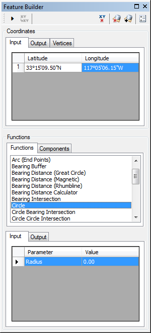
The Circle function creates a geodesic circle that can be used to represent a buffer surrounding a single bearing. The circle is created based on a single input point and a specified radius.

- Start ArcMap.
- On the menu bar, click Customize > Toolbars > Production Feature Builder.
- Click the Feature Builder button
 on the Production Feature Builder toolbar.
The Feature Builder window appears.
- If the scratch dataset has not been added to the table of contents, click the Add Scratch Data Layers button
 at the top of the Feature Builder window.
The dataset is added to the map using the current spatial reference.
- Choose Circle in the list on the Functions tab.

- Define a coordinate for the start point of the polyline by doing one of the following:
- Click the Pinprick tool
 on the Production Feature Builder toolbar and click on the map
 - Type the coordinates in the cells on the Input tab in the Coordinates area.
- Click the Pinprick tool
- Click the cell next to Radius and type a value for the radius of the circle.
This is the radius for the circle the function is going to create. The default unit is Nautical Miles.
- Click the Execute button
 .
.
A circle is created surrounding a central point.