You can create trade areas for the nationwide business locations that you have created and append demographic data.
-
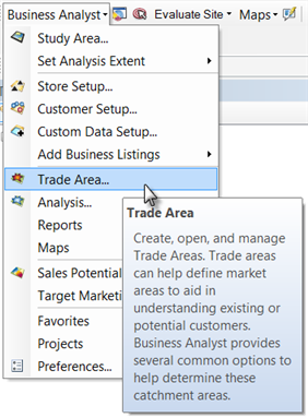
Click Business Analyst on the toolbar and click Trade Area.
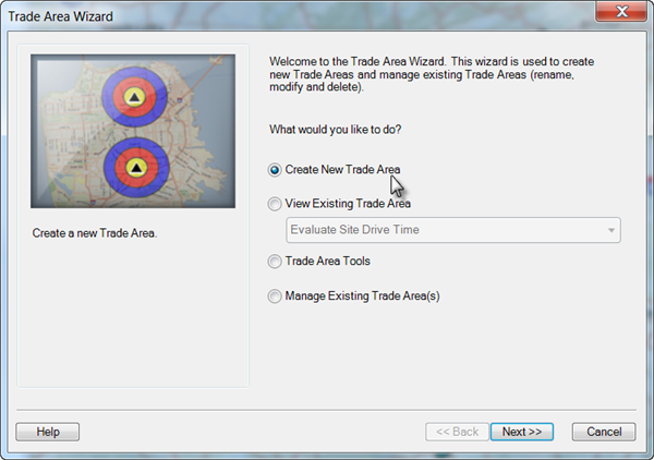
- On the Trade Area Wizard dialog box, click the Create New Trade Area button and click Next.
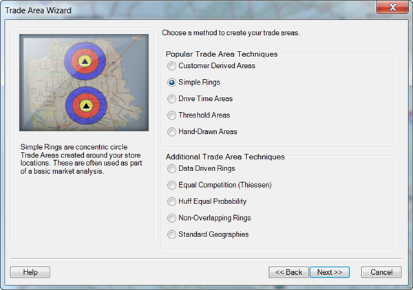
- On the Trade Area Wizard dialog box, click the Simple Rings button and click Next.
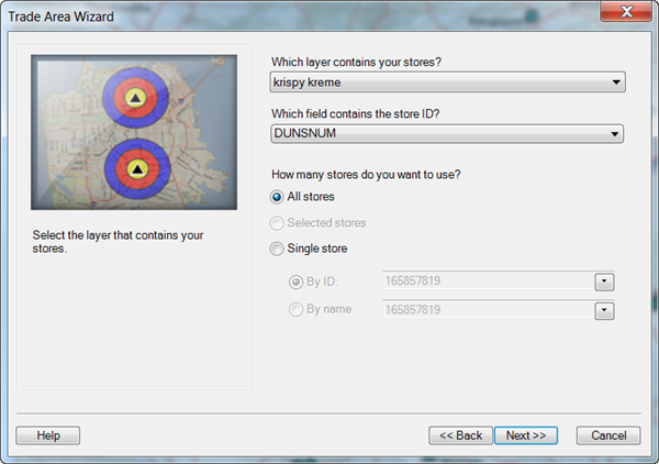
- On the Trade Area Wizard dialog box, click the Which layer contains your stores? drop-down menu and select krispy kreme.
- Select DUNSNUM in the Which field contains the store ID? drop-down menu.
- Click the All stores button for How many stores do you want to use? and click Next.
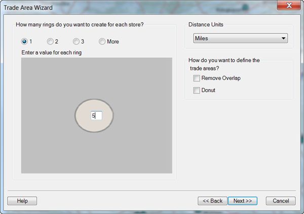
- On the Trade Area Wizard dialog box, click the 1 button, type 5 for the ring value and click Next.
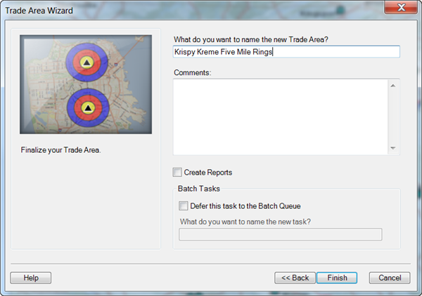
- On the Trade Area Wizard dialog box, type Krispy Kreme Five Mile Rings in the What do you want to name the new Trade Area? text box and click Finish.
The 5-mile simple ring trade areas are created around each of the business locations and define equal-sized markets around each site.
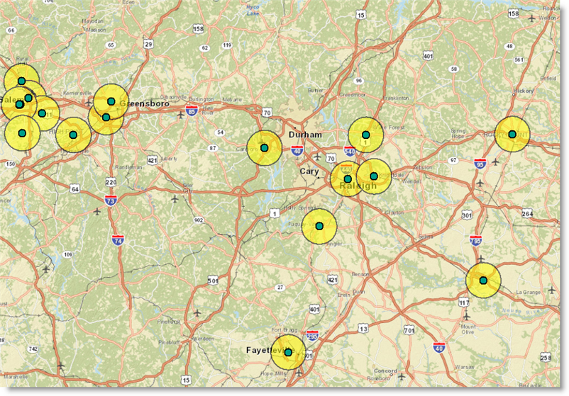
The 5-mile distance is typical of the distance a customer would travel to each local store. The polygons allow easy benchmarking between store locations nationwide. For example, you can compare each of the stores to determine which has the highest population within 5 miles or which has the lowest diversity. This is important when you analyze why certain stores perform better than others. To view these demographics, you will append the data to each of the ring locations.
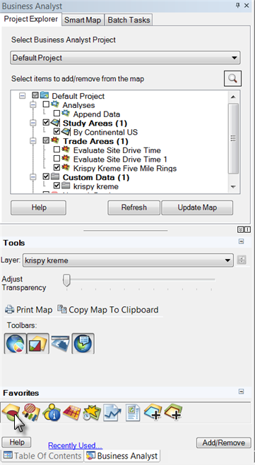
- Click the Business Analyst window button.

- Click the Append Data (Spatial Overlay) button in the Favorites section.

This is a shortcut to access tools through the Business Analyst menu.
- On the Append Data (Spatial Overlay) dialog box, click the Input Data Layer button and select Esri 2014 Business Analyst Base Data in the drop-down menu. Select Krispy Kreme Five Mile Rings in the Overlay Layer drop-down menu and click Next.
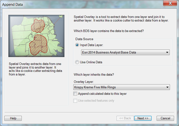
- On the Append Data (Spatial Overlay) dialog box, highlight the following categories under the Select one or more fields you want to use section and click the single right arrow to move it to the right column.
- <current year> Race and Hispanic Origin (Esri)
- <current year> Income (Esri)
- 2010 Households (U.S. Census)
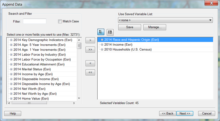
- Click Next.
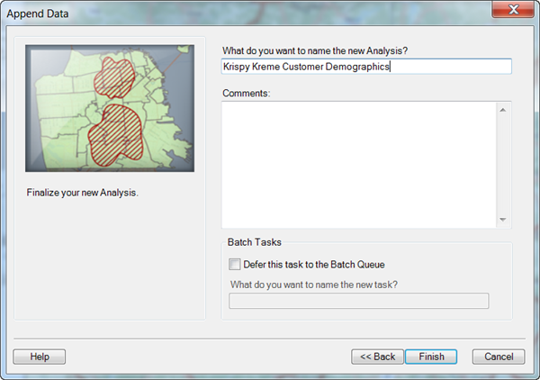
- On the Append Data (Spatial Overlay) dialog box below, type Krispy Kreme Customer Demographics in the What do you want to name the new Analysis? text box and click Finish.
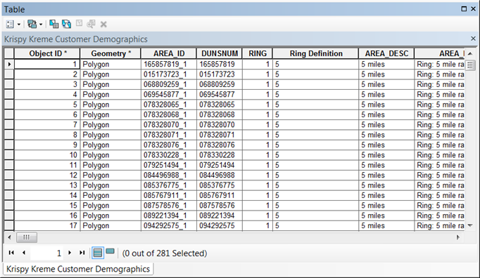
- Click the x in the red box to close the table.
Click Exercise 7: Refining your results with Smart Map Search to go to the next exercise.