Available with Standard or Advanced license.
The Load A Topology To A Parcel Fabric geoprocessing tool is performance intensive, and the number of parcels you can load at a time will depend on your computer configuration and memory availability. When working with a large parcel dataset, you can either split up the dataset into manageable sections of data or load selections of polygons or lines.
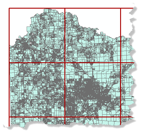
The Iteratively Load To The Parcel Fabric geoprocessing model can be used to iteratively load a topology to a parcel fabric based on an overlapping polygon grid. If you are loading parcel data into the parcel fabric Local Government Information Model, it may be necessary to iteratively load one or more of the topologies created for each parcel type in the staging environment.

Follow these steps to iteratively load a large topology to a parcel fabric.
- Download the Iteratively Load To The Parcel Fabric geoprocessing model.
- Open ArcMap and load the topology that will be migrated to a parcel fabric and its participating feature classes.
- Open the Create Fishnet geoprocessing tool located under System Toolboxes > Data Management Tools > Feature Class.
- On the Create Fishnet dialog box, enter a name and path for your polygon grid under Output Feature Class.
- Choose the topology you loaded into ArcMap from the Template Extent drop-down list.
- Enter 0 for both the Cell Size Width and Cell Size Height.
- Enter the number of rows and number of columns the fishnet will have under Number of Rows and Number of Columns.
- Uncheck Create Label Points.
- Choose POLYGON from the Geometry Type drop-down list.
- Click OK to create the fishnet.
- Navigate to the location of the downloaded iterative loading model and double-click the Iterate toolbox to open it.
- On the FabricLoad_Iterate dialog box, choose the fishnet you created and added to ArcMap from the Grid input drop-down list.
- Leave Group By Fields blank. Choose the source parcel polygons as the Input Feature Layer, and specify a parcel fabric for the Target Parcel Fabric.
- Populate the remaining Load A Topology To A Parcel Fabric geoprocessing tool parameters, and click OK to iteratively migrate the data.