Available with Standard or Advanced license.
You can choose how to view parcels and control the build behaviour of parcels on the Advanced tab on the Parcel Editor Options dialog box. To open the Parcel Editor Options dialog box, click Parcel Editor > Options.
Merge connected lines when building parcels
When building parcels from construction lines, you can choose to merge collinear parcel line segments into a single straight line. Parcel lines must be collinear, that is, there must be no bend angle at the points where the lines connect. Choose Merge connected lines at points where there is no bend on the Advanced tab on the Parcel Editor Options dialog box.
View parcels in a local coordinate system
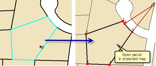
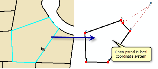
You can choose to open and edit the parcels individually in a separate, local coordinate data frame instead of in the projected map. When a parcel is opened in a local coordinate data frame, the parcel is displayed using the COGO dimensions on parcel lines (including scale and rotation).


Choose View and edit parcels individually in a local coordinate system on the Advanced tab on the Parcel Editor Options dialog box.