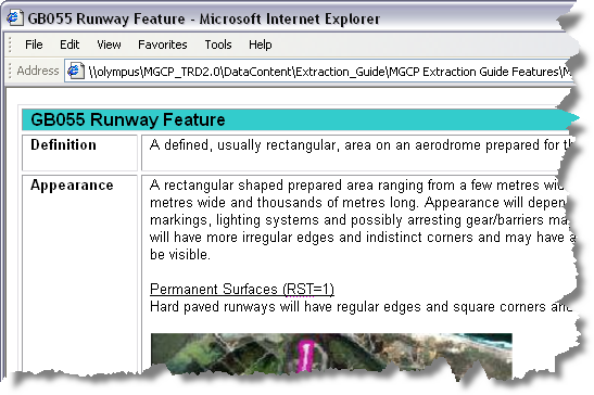
The Multinational Geospatial Co-production Program (MGCP) data model has an extraction guide that explains the specifications for generating features for each feature class subtype. This includes information about the way the features appear in imagery and how to identify them, as well as how to represent them in the feature class and populate their attributes.
If you have the extraction guide on a network machine or your local machine, you can indicate the path to it using the Extraction Guide Location tool, then use the MGCP Show Extraction Guide tool to view extraction information for the feature class subtype you choose. The MGCP Show Extraction Guide tool displays extraction information for the subtype you choose on the Create tab on the Manage Features window. For instance, if you choose the GB055 Runway Area subtype, the GB055 Runway Feature page of the extraction guide displays in a Web browser.

- Start ArcMap.
- Load MGCP data in the map.
- On the main menu, click Customize > Toolbars > Production Editing.
- On the main menu, click Customize > Toolbars > Defense Mapping MGCP Tools.
- Click the Production Start Editing button
 on the Production Editing toolbar.
- Specify the path to the extraction guide by doing the following:
- Click the Extraction Guide Location button
 on the Defense Mapping MGCP Tools toolbar.
 - Click the ellipsis (...) button next to the TRD Extraction Guide Location text box.
The Browse For Folder dialog box appears.
- Navigate to the directory that contains the extraction guide.
- Click OK.
The path to the extraction guide appears in the TRD Extraction Guide Location text box.
- Click OK.
- Click the Extraction Guide Location button
- Click the Create tab on the Manage Features window.
- Choose the feature class subtype for which you want to view the extraction information.
- Click the MGCP Show Extraction Guide button
 on the Defense Mapping MGCP Tools toolbar.
A Web page with the extraction information appears.