The Geostatistical Analyst addresses a wide range of different application areas. The following is a small sampling of applications in which Geostatistical Analyst was used.
Exploratory spatial data analysis
Using measured sample points from a study area, Geostatistical Analyst was used to create accurate predictions for other unmeasured locations within the same area. Exploratory spatial data analysis tools included with Geostatistical Analyst were used to assess the statistical properties of data such as spatial data variability, spatial data dependence, and global trends.
A number of exploratory spatial data analysis tools were used in the example below to investigate the properties of ozone measurements taken at monitoring stations in the Carpathian Mountains.

Semivariogram modeling
Geostatistical analysis of data occurs in the following phases:
- Modeling the semivariogram or covariance to analyze surface properties
- Kriging
A number of kriging methods are available for surface creation in Geostatistical Analyst, including ordinary, simple, universal, indicator, probability, and disjunctive kriging.
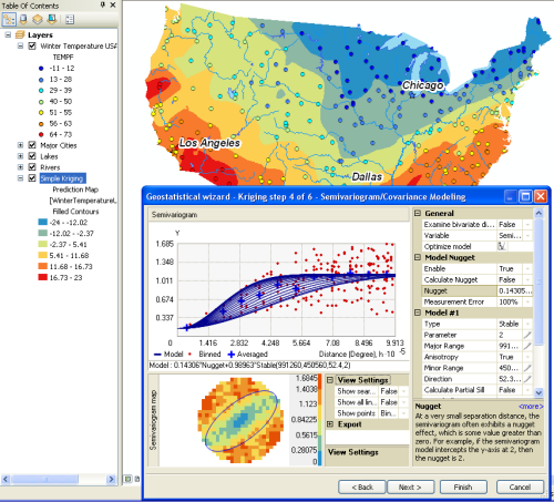
The following illustrates the two phases of geostatistical analysis of data. First, the Semivariogram/Covariance wizard was used to fit a model to winter temperature data for the United States. This model was then used to create the temperature distribution map.

Surface prediction and error modeling
Various types of map layers can be produced using Geostatistical Analyst, including prediction maps, quantile maps, probability maps, and prediction standard error maps.
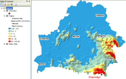
The following shows Geostatistical Analyst used to produce a prediction map of radiocesium soil contamination levels in the country of Belarus after the Chernobyl nuclear power plant accident.

Threshold mapping
Probability maps can be generated to predict where values exceed a critical threshold.
In the example below, locations shown in dark orange and red indicate a probability greater than 62.5 percent that radiocesium contamination exceeds the upper permissible level (critical threshold) in forest berries.

Model validation and diagnostics
Input data can be split into two subsets. The first subset of the available data can be used to develop a model for prediction. The predicted values are then compared with the known values at the remaining locations using the Validation tool.
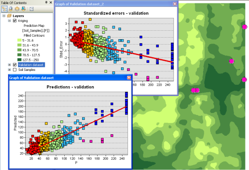
The following shows the Validation wizard used to assess a model developed to predict organic matter for a farm in Illinois.

Surface prediction using cokriging
Cokriging, an advanced surface modeling method included in Geostatistical Analyst, can be used to improve surface prediction of a primary variable by taking into account secondary variables, provided that the primary and secondary variables are spatially correlated.
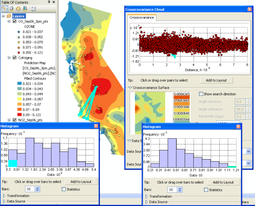
In the following example, exploratory spatial data analysis tools are used to explore spatial correlation between ozone (primary variable) and nitrogen dioxide (secondary variable) in California. Because the variables are spatially correlated, cokriging can use the nitrogen dioxide data to improve predictions when mapping ozone.
