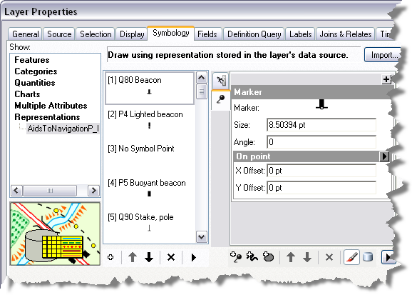
The symbology that results from an automated process is a starting point for chart creation. Cartographers usually need to edit the resulting symbols and annotation to remove overprinting and improve the clarity and legibility of the chart. Edits made to representations do not affect the underlying geometry when using the Nautical symbology configured for paper chart products that are provided with ArcGIS Maritime.
When you rotate the data frame for a non-north-up chart, you may notice that some symbols in the chart point to geographic north instead of to the top of the page. To change the rotation of the symbols from geographic north to the top of the page, follow the steps below.
- Start ArcMap.
- Open the product map document.
- Double-click the layer that needs symbols rotated to the top of the page.
The Layer Properties dialog box appears.

- Click the Symbology tab if necessary.
- Click a representation rule to rotate.
- Type a value in the Angle text box in the Marker properties area of the form.
- Click OK.
The symbols are rotated to the top of the page.
- Repeat steps 3 through 7 for all markers that need to be rotated.