In ArcGIS Maritime, the quality of position and positional accuracy attributes can be encoded along a portion of a feature using the PLTS_SpatialAttributesL feature class. When a PLTS_SpatialAttributesL feature is detected coincident with the edge of a feature at the time of export, the feature will receive the quality and accuracy encoding found in the coincident PLTS_SpatialAttributesL feature.
When editing, it is also important to consider existing PLTS_SpatialAttributesL features. If features that share coincidence with the spatial attributes features are moved, the PLTS_SpatialAttributesL feature must also be moved; or if no longer required, it should be deleted.
The following steps describe how to create an approximate Quality of Position (QUAPOS) attribute along the portion of a coastline feature.
- Start ArcMap.
- On the main menu, click Customize > Toolbars > Production Editing.
- Open the Catalog window.
- Browse to the product library of choice.
- Open the Table Of Contents window.
-
Connect to the product library AOI and add the PLTS_SpatialAttributesL layer.
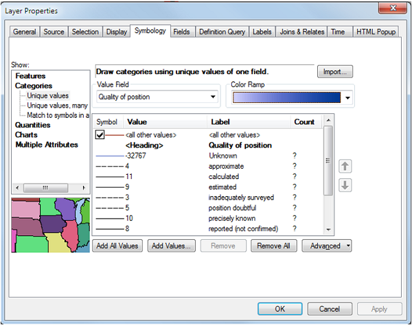
The Layer Properties dialog box appears.

- Under Categories, click Unique values.
- Click the Value Field drop-down arrow and choose Quality of position.
- Open the Table Of Contents window.
- Connect to the product library AOI in the Catalog window and add the CoastlineL layer.
- Ensure that the compilation scale on the Nautical toolbar is set at a value that is similar to the compilation scale file at which you want to capture the spatial attribute features.
- Click the Production Start Editing button
 on the Production Editing toolbar to begin editing.
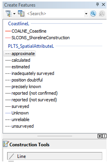
The Create Features window appears.

- Choose a template, for example, approximate.
- Click the Construction Tools drop-down arrow and choose Line to insert the PLTS_SpatialAttributesL feature.
- Click the Edit Vertices button
 on the Production Editing toolbar to begin editing.
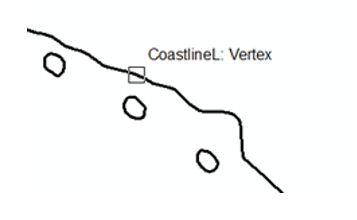
 - Place the pointer over the CoastlineL feature where you want to begin creating the approximate attribute.
You'll see the snapping pointer change as in the next image before you begin to trace.

- Click the Production Trace button
 on the Production Editing toolbar.
 - Slowly move the pointer along the CoastlineL feature to create the SpatialAttributeL feature.
The Production Trace tool begins to draw the feature along the coastline.
- Double-click to end the tracing process.
- Click the Save Edits button
 on the Production Editing toolbar to save changes.
When the product is exported, the coastline will have an approximate edge encoded along the portion where the PLTS_SpatialAttributesL feature was created.